IMAGES TAKEN NEAR TO
Lyne Lane, VIRGINIA WATER, GU25 4ES
Introduction
This page details the photographs taken nearby to Lyne Lane, GU25 4ES by members of the Geograph project.
The Geograph project started in 2005 with the aim of publishing, organising and preserving representative images for every square kilometre of Great Britain, Ireland and the Isle of Man.

There are currently over 7.5m images from over14,400 individuals and you can help contribute to the project by visiting https://www.geograph.org.uk
Image Map
Images are licensed for reuse under creativecommons.org/licenses/by-sa/2.0
Notes
- Clicking on the map will re-center to the selected point.
- The higher the marker number, the further away the image location is from the centre of the postcode.
Image Listing (20 Images Found)
Images are licensed for reuse under creativecommons.org/licenses/by-sa/2.0
Image
Details
Distance
1
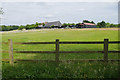
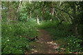
Redlands Farm
The buildings of Redlands Farm near Lyne from the footpath to Bridge Lane.
Image: © Alan Hunt
Taken: 25 Jun 2015
0.04 miles
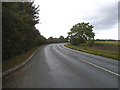
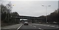
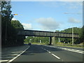
6
Railway bridge over the M3
The branch line to Virginia Water.
Image: © N Chadwick
Taken: 2 Jan 2011
0.14 miles
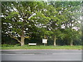
8
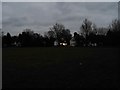
Bourne Copse near Lyne
A small area of woodland to the south of the M3 near junction 2.
Image: © Alan Hunt
Taken: 25 Jun 2015
0.15 miles
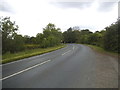
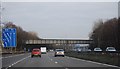
10
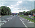
M3 Weybridge to Virginia Water railway line crosses
Image: © Stuart Logan
Taken: 17 Aug 2012
0.15 miles