IMAGES TAKEN NEAR TO
Guildown Avenue, GUILDFORD, GU2 4HB
Introduction
This page details the photographs taken nearby to Guildown Avenue, GU2 4HB by members of the Geograph project.
The Geograph project started in 2005 with the aim of publishing, organising and preserving representative images for every square kilometre of Great Britain, Ireland and the Isle of Man.

There are currently over 7.5m images from over14,400 individuals and you can help contribute to the project by visiting https://www.geograph.org.uk
Image Map
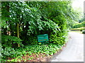
Images are licensed for reuse under creativecommons.org/licenses/by-sa/2.0
Notes
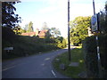
- Clicking on the map will re-center to the selected point.
- The higher the marker number, the further away the image location is from the centre of the postcode.
Image Listing (106 Images Found)
Images are licensed for reuse under creativecommons.org/licenses/by-sa/2.0
Image
Details
Distance
1
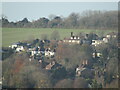
Guildford - Rural-Urban Fringe
The upmarket south-west suburbs of Guildford are on a hillside at Artington and abut arable land.
www.guildford.gov.uk
Image: © Colin Smith
Taken: 25 Nov 2022
0.04 miles
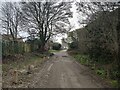
2
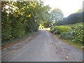
The old road to the Hog's Back
The principal road over the Hog's Back nowadays in the A31 trunk road, but this trackway is a much older route that goes straight up the escarpment from Guildford. It is metalled as far as a camp site at SU982487 and west of there is unsurfaced.
Image: © Stephen Craven
Taken: 1 Nov 2008
0.07 miles
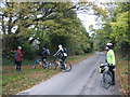
4

Along the Hog's Back
Taken on my way up to the top of Hog's Back (known locally as 'the mound'), south of Farnham Road as it leaves Guildford, Surrey, I am looking across the crest of the hill towards the centre of Guildford.
Image: © Carroll Pierce
Taken: 9 Sep 2016
0.09 miles
5
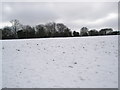
A snowy field between The Mount and Wodeland Avenue
Image: © Basher Eyre
Taken: 7 Feb 2009
0.09 miles
7
Cul-de-sac on Guildown Road
There is a public footpath sign pointing along the road though this is not mapped as such.
Image: © Shazz
Taken: 29 Jun 2014
0.11 miles
9
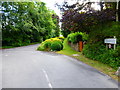
Road junction at west end of Upper Guildown Road
Image: © Shazz
Taken: 29 Jun 2014
0.11 miles
10
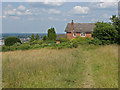
House on the Mount
The end of the built up area of the Mount from the open access land of Guildown.
Image: © Alan Hunt
Taken: 14 Jul 2013
0.11 miles