IMAGES TAKEN NEAR TO
Guildown Road, GUILDFORD, GU2 4ET
Introduction
This page details the photographs taken nearby to Guildown Road, GU2 4ET by members of the Geograph project.
The Geograph project started in 2005 with the aim of publishing, organising and preserving representative images for every square kilometre of Great Britain, Ireland and the Isle of Man.

There are currently over 7.5m images from over14,400 individuals and you can help contribute to the project by visiting https://www.geograph.org.uk
Image Map
Images are licensed for reuse under creativecommons.org/licenses/by-sa/2.0
Notes
- Clicking on the map will re-center to the selected point.
- The higher the marker number, the further away the image location is from the centre of the postcode.
Image Listing (127 Images Found)
Images are licensed for reuse under creativecommons.org/licenses/by-sa/2.0
Image
Details
Distance
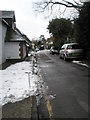
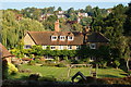
2
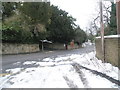
View from Chestnut Avenue across Guildown Road towards Beech Lane
Image: © Basher Eyre
Taken: 7 Feb 2009
0.05 miles
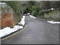
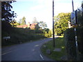
4
Junction of Guildown Road and Beech Lane
Image: © Basher Eyre
Taken: 7 Feb 2009
0.06 miles
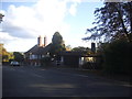
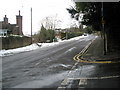
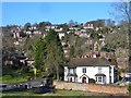
6
View From Sandy Lane, Guildford, Surrey
Looking towards the outskirts of Guildford, on the slopes of the North downs.
Image: © Peter Trimming
Taken: 27 Sep 2009
0.07 miles
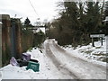
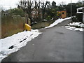
7
Guildford - From St Catherine's Hill
View towards Guildown, an upmarket housing area on the east end of the chalky Hogsback ridge.
Image: © Colin Smith
Taken: 17 Feb 2015
0.08 miles