
IMAGES TAKEN NEAR TO
Angelica Road, WOKING, GU24 9EY
Introduction
This page details the photographs taken nearby to Angelica Road, GU24 9EY by members of the Geograph project.
The Geograph project started in 2005 with the aim of publishing, organising and preserving representative images for every square kilometre of Great Britain, Ireland and the Isle of Man.

There are currently over 7.5m images from over14,400 individuals and you can help contribute to the project by visiting https://www.geograph.org.uk
Image Map
Images are licensed for reuse under creativecommons.org/licenses/by-sa/2.0
Notes
- Clicking on the map will re-center to the selected point.
- The higher the marker number, the further away the image location is from the centre of the postcode.
Image Listing (57 Images Found)
Images are licensed for reuse under creativecommons.org/licenses/by-sa/2.0
Image
Details
Distance
1
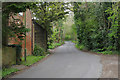
Clews Lane, Bisley
The narrow road running from the A322 to Church Lane with the buildings of Clews Farm on the left.
Image: © Alan Hunt
Taken: 2 May 2016
0.05 miles
4
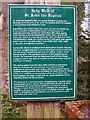
The Holy Well of St John the Baptist
The plaque detailing the history of the Holy Well of St John the Baptist at Bisley. For a view of the well refer to picture Image
Image: © Len Williams
Taken: 21 Apr 2014
0.07 miles
5
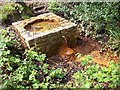
The Holy Well at Bisley
This is the source of the spring at Bisley which forms the Holy Well of St John the Baptist. Originally used by the Abbey at Chertsey, (now defunct), as a source of Holy Water. For details of the well's history refer to picture Image
Image: © Len Williams
Taken: 21 Apr 2014
0.07 miles
6
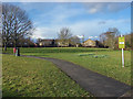
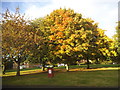
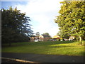
Clews Lane open area
The recreation area in the Flowers estate, Bisley. All the roads in this estate are named after flowers.
Image: © Alan Hunt
Taken: 23 Feb 2015
0.08 miles
7
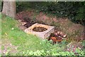
The Holy Well of St John the Baptist
This well is close to the church of St John the Baptist at Bisley, and is a Grade II listed building. From a sign on the site: "Reputedly this ancient well has never run dry or frozen up. It has provided a dependable supply of fresh water for centuries and was mentioned more than 300 years ago by John Aubrey, the Surrey antiquarian. Earlier still, there is evidence from the Pyrford Charter Bounds (956AD) suggesting that a church had been constructed near the well when Christianity became the official religion of the Roman empire. The spring water contains a significant amount of dissolved iron (as the rusty colour of the outflow shows). The well was restored by local volunteers in 2002 when an ugly concrete cap was removed.
Image: © Ron Strutt
Taken: 28 Sep 2005
0.11 miles
8
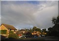
Elder Road at the junction of Angelica Road
You can just see a rainbow if you look carefully
Image: © David Howard
Taken: 16 Oct 2016
0.11 miles
9
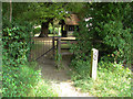
Bisley Church
The gate at the back of the churchyard on the footpath that leads to the Holy Well
Image: © Alan Hunt
Taken: 4 Jul 2010
0.11 miles
10
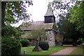
Bisley church
Bisley church is situated some distance from the centre of the modern village and probably the original settlement too. Its siting may have had something to do with the presence nearby of a spring, and the present building might be on the site of an earlier church or possibly even that of a pagan temple, many of which were sited near water. The 14th century porch is made of massive pieces of timber and is overlooked by a large old yew tree. The proposed Bisley bypass was to have passed only a short distance from the church and would have shattered its rural seclusion, but the plan has been shelved, at least for the time being.
Image: © Ron Strutt
Taken: 28 Sep 2005
0.11 miles