
IMAGES TAKEN NEAR TO
Clews Lane, WOKING, GU24 9DY
Introduction
This page details the photographs taken nearby to Clews Lane, GU24 9DY by members of the Geograph project.
The Geograph project started in 2005 with the aim of publishing, organising and preserving representative images for every square kilometre of Great Britain, Ireland and the Isle of Man.

There are currently over 7.5m images from over14,400 individuals and you can help contribute to the project by visiting https://www.geograph.org.uk
Image Map
Images are licensed for reuse under creativecommons.org/licenses/by-sa/2.0
Notes
- Clicking on the map will re-center to the selected point.
- The higher the marker number, the further away the image location is from the centre of the postcode.
Image Listing (58 Images Found)
Images are licensed for reuse under creativecommons.org/licenses/by-sa/2.0
Image
Details
Distance
1
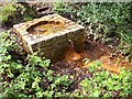
The Holy Well at Bisley
This is the source of the spring at Bisley which forms the Holy Well of St John the Baptist. Originally used by the Abbey at Chertsey, (now defunct), as a source of Holy Water. For details of the well's history refer to picture Image
Image: © Len Williams
Taken: 21 Apr 2014
0.07 miles
2
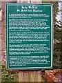
The Holy Well of St John the Baptist
The plaque detailing the history of the Holy Well of St John the Baptist at Bisley. For a view of the well refer to picture Image
Image: © Len Williams
Taken: 21 Apr 2014
0.07 miles
3
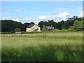
Field alongside Clews Lane
The field alongside Clews Lane with the houses on Church Lane on the far side.
Image: © Alan Hunt
Taken: 5 Aug 2012
0.07 miles
4
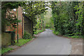
Clews Lane, Bisley
The narrow road running from the A322 to Church Lane with the buildings of Clews Farm on the left.
Image: © Alan Hunt
Taken: 2 May 2016
0.07 miles
5
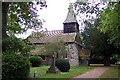
Bisley church
Bisley church is situated some distance from the centre of the modern village and probably the original settlement too. Its siting may have had something to do with the presence nearby of a spring, and the present building might be on the site of an earlier church or possibly even that of a pagan temple, many of which were sited near water. The 14th century porch is made of massive pieces of timber and is overlooked by a large old yew tree. The proposed Bisley bypass was to have passed only a short distance from the church and would have shattered its rural seclusion, but the plan has been shelved, at least for the time being.
Image: © Ron Strutt
Taken: 28 Sep 2005
0.07 miles
6
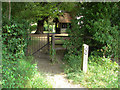
Bisley Church
The gate at the back of the churchyard on the footpath that leads to the Holy Well
Image: © Alan Hunt
Taken: 4 Jul 2010
0.07 miles
7
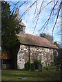
Bisley Parish Church
Modern Bisley lies well to the west of the old church. The church was founded in 13th Century and received 19th Century renovation.
Image: © Colin Smith
Taken: 28 Nov 2009
0.09 miles
8
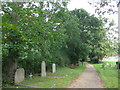
St John the Baptist, Bisley: churchyard (v)
Image: © Basher Eyre
Taken: 7 Sep 2015
0.09 miles
9
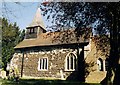
St John the Baptist, Bisley
Grade 2* listed building erected in the 13th century.
Image: © Michael FORD
Taken: Unknown
0.09 miles
10
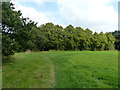
Footpath towards church, Bisley
The church is rather obscured by trees in the summer for views from within the churchyard, so a more distant view was sought. From this direction it is totally obscured!
Image: © Robin Webster
Taken: 13 Sep 2014
0.09 miles