
IMAGES TAKEN NEAR TO
Caterham Close, WOKING, GU24 0JA
Introduction
This page details the photographs taken nearby to Caterham Close, GU24 0JA by members of the Geograph project.
The Geograph project started in 2005 with the aim of publishing, organising and preserving representative images for every square kilometre of Great Britain, Ireland and the Isle of Man.

There are currently over 7.5m images from over14,400 individuals and you can help contribute to the project by visiting https://www.geograph.org.uk
Image Map
Images are licensed for reuse under creativecommons.org/licenses/by-sa/2.0
Notes
- Clicking on the map will re-center to the selected point.
- The higher the marker number, the further away the image location is from the centre of the postcode.
Image Listing (192 Images Found)
Images are licensed for reuse under creativecommons.org/licenses/by-sa/2.0
Image
Details
Distance
1
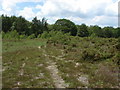
Dawney Hill
This area of dry heath has been managed by the Surrey Heathland Project with spectacular success. It now has a healthy population of the Silver Studded Blue butterfly which thrives on the regenerating heather growing in this dry sandy substrate. The Silver Studded Blue is a species of high conservation concern. The Heaths of Surrey, Hampshire and Dorset hold the largest populations in Britain and are the subject of a major conservation effort to maintain this threatened habitat.
Image: © Alan Hunt
Taken: 13 Jun 2010
0.05 miles
2
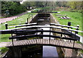
The Basingstoke Canal at Brookwood
Looking westwards at MR: SU943569
Image: © Andy Beecroft
Taken: 24 Apr 2004
0.07 miles
3
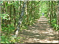
Woodland Path by Pirbright Common
Firm-surfaced and wide path through deciduous woodland north of Pirbright.
Image: © Colin Smith
Taken: 4 Jun 2011
0.07 miles
4

Dawney Hill, Pirbright
Bus stops at Dawney Hill.
Image: © Paul E Smith
Taken: 13 Sep 2009
0.07 miles
5
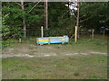
Dawney Hill
A colourful water trough on the heath at Dawney Hill
Image: © Alan Hunt
Taken: 13 Jun 2010
0.08 miles
6
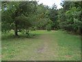
Dawney Hill
Pines at the north east corner of Dawney Hill Common
Image: © Alan Hunt
Taken: 13 Jun 2010
0.09 miles
7
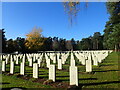
The Canadian section of Brookwood Military Cemetery
Brookwood Cemetery, also known as the London Necropolis, is the largest cemetery in the United Kingdom and one of the largest in Europe. The cemetery is Grade I Listed. The original cemetery opened to the public on 13th November 1854 when its first burials took place. See https://en.wikipedia.org/wiki/Brookwood_Cemetery for the full history of Brookwood Cemetery, including the military cemeteries.
There is an enormous area of war graves including British, American, Canadian, French, Polish, Czech, Italian and German sections, as well as a separate section for Chelsea Pensioners. Brookwood Military Cemetery covers about 37 acres and is the largest Commonwealth war cemetery in the United Kingdom. The land was set aside during the First World War to provide a burial site for men and women of Commonwealth and American armed forces who died in the United Kingdom of wounds and other causes.
This is in the Canadian section which is the first part which the visitor reaches when approaching from Dawney Hill.
Image: © Marathon
Taken: 13 Nov 2022
0.10 miles
8
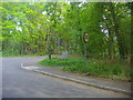
Junction of Gole Road and A324 Brookwood
Image: © David Howard
Taken: 1 May 2011
0.11 miles
9
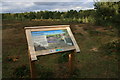
Dawney's Common
New heathland information board at Dawney's Common.
Image: © Paul E Smith
Taken: 13 Sep 2009
0.12 miles
10
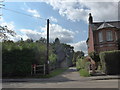
Junction of Dawney Hill and the footpath to School Lane
Image: © Basher Eyre
Taken: 7 Sep 2015
0.12 miles