
IMAGES TAKEN NEAR TO
Lower Sandfields, WOKING, GU23 7AX
Introduction
This page details the photographs taken nearby to Lower Sandfields, GU23 7AX by members of the Geograph project.
The Geograph project started in 2005 with the aim of publishing, organising and preserving representative images for every square kilometre of Great Britain, Ireland and the Isle of Man.

There are currently over 7.5m images from over14,400 individuals and you can help contribute to the project by visiting https://www.geograph.org.uk
Image Map
Images are licensed for reuse under creativecommons.org/licenses/by-sa/2.0
Notes
- Clicking on the map will re-center to the selected point.
- The higher the marker number, the further away the image location is from the centre of the postcode.
Image Listing (19 Images Found)
Images are licensed for reuse under creativecommons.org/licenses/by-sa/2.0
Image
Details
Distance
4
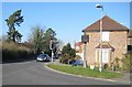
Send: Queen Elizabeth II Jubilee commemoration tablet
Send's Jubilee commemoration tablet, celebrating 25 years of Queen Elizabeth II's reign from 1952 to 1977, is mounted on a post at the junction of the A247 Send Road / Send Barns Lane with the B368 Send Marsh Road. The seat next to it is in a curious position, offering unrestricted view of the traffic light phasing and the busy vehicle movements, but little else...
Image: © Nigel Cox
Taken: 17 Feb 2008
0.06 miles
5
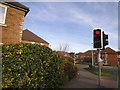
Send Road at the junction of Send Marsh Road
Image: © David Howard
Taken: 5 Oct 2014
0.07 miles
6
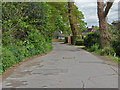
Bush Lane, Send
The cul-de-sac of Bush Lane looking towards the junction with Send Hill.
Image: © Alan Hunt
Taken: 13 May 2013
0.08 miles
7
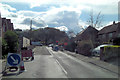
Temporary traffic lights at May's Corner
When the light go green Send Hill is straight on, Send Road to the right and Send Barnes Lane to the left. It's enough to send you wild with delight!
Image: © Stuart Logan
Taken: 20 Apr 2012
0.08 miles
8
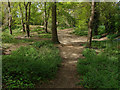
Woods, Send Hill
The small area of open access wood off Send Hill.
Image: © Alan Hunt
Taken: 13 May 2013
0.08 miles
9
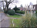
Bush Lane, Send
Quiet residential, suburban cul-de-sac between Send Hill and St Bede's School. It is lined by a mixture of bungalows and cottages.
Image: © Colin Smith
Taken: 23 Feb 2008
0.11 miles
10
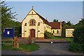
The former Catholic Church of St. William of York, Send Marsh Road, Send
The church, in a very simple Gothic style, was opened and blessed on Sunday 29th December 1939. The architect was Charles Purcell of Pugin & Pugin. It was named after Sir William of York who in the 12th century was twice Archbishop of York. His second tenure was brief and there is some belief that he was poisoned. Over twenty years after his death, miracles began to be reported at his tomb and then in 1227 he was declared a saint.
The church closed in 2007 and was sold in late 2011. The Send Village Community Website says that "it may become a private house". When photographed in May 2012, nothing seemed to be happening except there was a caravan parked next to the church. It is difficult to imagine what sort of house this church would convert to. It is much larger than the sort of chapel that is frequently converted into a dwelling.
Image: © P L Chadwick
Taken: 24 May 2012
0.11 miles