IMAGES TAKEN NEAR TO
Maple Grove, WOKING, GU22 9PJ
Introduction
This page details the photographs taken nearby to Maple Grove, GU22 9PJ by members of the Geograph project.
The Geograph project started in 2005 with the aim of publishing, organising and preserving representative images for every square kilometre of Great Britain, Ireland and the Isle of Man.

There are currently over 7.5m images from over14,400 individuals and you can help contribute to the project by visiting https://www.geograph.org.uk
Image Map
Images are licensed for reuse under creativecommons.org/licenses/by-sa/2.0
Notes
- Clicking on the map will re-center to the selected point.
- The higher the marker number, the further away the image location is from the centre of the postcode.
Image Listing (24 Images Found)
Images are licensed for reuse under creativecommons.org/licenses/by-sa/2.0
Image
Details
Distance
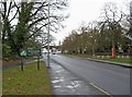
1
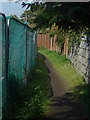
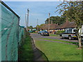
Footpath, Hoe Valley
The footpath that runs behind Maple Road with the fence of the Hoe Valley flood relief scheme on the left.
Image: © Alan Hunt
Taken: 1 Oct 2011
0.06 miles
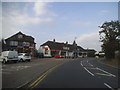
2
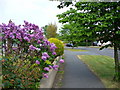
Westfield Avenue
Suburban Woking - a street of bungalows south of the borough centre.
Image: © Colin Smith
Taken: 28 Apr 2007
0.08 miles
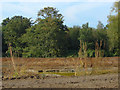
3
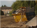
The Hoe Valley
A view across the working area of the Hoe Valley flood relief scheme with the houses on Willow Way in the background.
Image: © Alan Hunt
Taken: 1 Oct 2011
0.12 miles
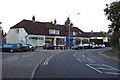
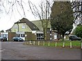
6
Westfield Road
A group of local shops are on the corner, in the distance.
Image: © P L Chadwick
Taken: 12 Mar 2010
0.13 miles
7
The Hoe Valley
Looking across the working area of the Hoe Valley flood relief scheme from the footpath behind Chestnut Road
Image: © Alan Hunt
Taken: 1 Oct 2011
0.13 miles
8
Chestnut Road, Kingfield
A view of the end of Chestnt Road with the safety fence of the Hoe Valley flood relief scheme on the left
Image: © Alan Hunt
Taken: 1 Oct 2011
0.14 miles
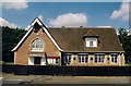
9
Old Woking & District Recreation Club, 33 Westfield Road
A sign outside indicates that the club's facilities include bowls, darts, pool, and snooker. A function room is also available. The club is CIU affiliated.
Image: © P L Chadwick
Taken: 12 Mar 2010
0.15 miles