IMAGES TAKEN NEAR TO
Church Hill, WOKING, GU22 8XH
Introduction
This page details the photographs taken nearby to Church Hill, GU22 8XH by members of the Geograph project.
The Geograph project started in 2005 with the aim of publishing, organising and preserving representative images for every square kilometre of Great Britain, Ireland and the Isle of Man.

There are currently over 7.5m images from over14,400 individuals and you can help contribute to the project by visiting https://www.geograph.org.uk
Image Map
Images are licensed for reuse under creativecommons.org/licenses/by-sa/2.0
Notes
- Clicking on the map will re-center to the selected point.
- The higher the marker number, the further away the image location is from the centre of the postcode.
Image Listing (61 Images Found)
Images are licensed for reuse under creativecommons.org/licenses/by-sa/2.0
Image
Details
Distance
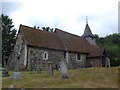
1
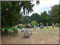
Church Hill passes The Church of St. Nicholas
Image: © Stuart Logan
Taken: 20 Apr 2012
0.02 miles
2
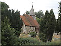
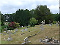
The Church of St.Nicholas - Pyrford
Taken from the graveyard across Church Hill to The Church of St. Nicholas, Pyrford
Image: © Doug Beaton
Taken: 25 Aug 2003
0.02 miles
4
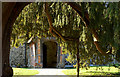
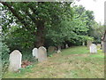
A yew tree tunnel St Nicholas
A very hot sunny day in 2006 the yew provided a shelter from sun to eat lunch.
Image: © Alan Varndell
Taken: 6 Apr 2006
0.02 miles
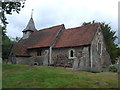
5
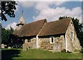
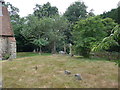
St Nicholas, Pyrford
Grade 1 listed building erected in the 12th century.
Image: © Michael FORD
Taken: Unknown
0.02 miles