IMAGES TAKEN NEAR TO
Sandy Lane, WOKING, GU22 8TS
Introduction
This page details the photographs taken nearby to Sandy Lane, GU22 8TS by members of the Geograph project.
The Geograph project started in 2005 with the aim of publishing, organising and preserving representative images for every square kilometre of Great Britain, Ireland and the Isle of Man.

There are currently over 7.5m images from over14,400 individuals and you can help contribute to the project by visiting https://www.geograph.org.uk
Image Map
Images are licensed for reuse under creativecommons.org/licenses/by-sa/2.0
Notes
- Clicking on the map will re-center to the selected point.
- The higher the marker number, the further away the image location is from the centre of the postcode.
Image Listing (39 Images Found)
Images are licensed for reuse under creativecommons.org/licenses/by-sa/2.0
Image
Details
Distance
1
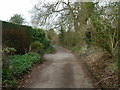
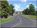
Sandy Lane
A public bridleway, over this comparatively short northern section also used for residential access.
Image: © Robin Webster
Taken: 20 Mar 2012
0.02 miles
2
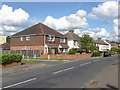
Sandy Lane
The bridleway only part of Sandy Lane reaches the part shared with supposedly private vehicle access.
Image: © Robin Webster
Taken: 20 Mar 2012
0.03 miles
4
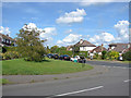
Floyd's Lane
A view along Floyd's Lane from its junction with Boltons Lane. The former Rowley Bristow Hospital, once one of Britains leading orthopoedic hospitals, was behind the fence on the right. The old hospital has been converted to a private gated estate.
Image: © Alan Hunt
Taken: 14 Aug 2012
0.06 miles
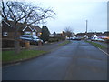
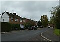
6
Boltons Lane
The junction on Engliff Lane with Boltons Lane in West Byfleet's Ridgeway estate
Image: © Alan Hunt
Taken: 14 Aug 2012
0.10 miles
7
Floyd's Lane
A view along Floyd's Lane in the West Byfleet Ridgeway estate. The side road is Longs Close, a short cul-de-sac.
Image: © Alan Hunt
Taken: 14 Aug 2012
0.11 miles
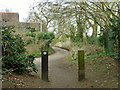
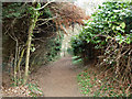
9
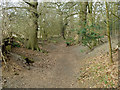
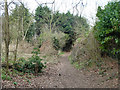
Sunken bridleway, Pyrford
The soil here is very sandy, so easily eroded but free draining. The route is actually called Sandy Lane.
Image: © Robin Webster
Taken: 20 Mar 2012
0.13 miles