IMAGES TAKEN NEAR TO
Lovelace Drive, WOKING, GU22 8QZ
Introduction
This page details the photographs taken nearby to Lovelace Drive, GU22 8QZ by members of the Geograph project.
The Geograph project started in 2005 with the aim of publishing, organising and preserving representative images for every square kilometre of Great Britain, Ireland and the Isle of Man.

There are currently over 7.5m images from over14,400 individuals and you can help contribute to the project by visiting https://www.geograph.org.uk
Image Map
Images are licensed for reuse under creativecommons.org/licenses/by-sa/2.0
Notes
- Clicking on the map will re-center to the selected point.
- The higher the marker number, the further away the image location is from the centre of the postcode.
Image Listing (17 Images Found)
Images are licensed for reuse under creativecommons.org/licenses/by-sa/2.0
Image
Details
Distance
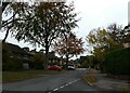
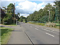
1
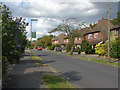
Lovelace Drive
Lovelace Drive, a residential road on the Pyrford Wood estate.
Image: © Alan Hunt
Taken: 20 Aug 2012
0.07 miles
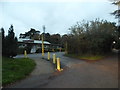
3
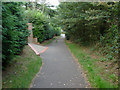
Teggs Lane
The footpath/access road that connects Coldharbour Road with Lovelace Drive on the Pyrford Wood estate.
Image: © Alan Hunt
Taken: 20 Aug 2012
0.14 miles
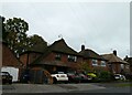
4
Pavement up on Lovelace Drive
Signs said "Please use the other pavement" but that was up at less frequent intervals too. It seemed to be gas pipe replacement.
Image: © Robin Webster
Taken: 20 Mar 2012
0.15 miles
6
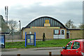
The Arbor Centre
'Pyrford Guides and Scouts Parents Association', but other outfits seem to use it as well, perhaps even Guides and Scouts.
Image: © Robin Webster
Taken: 20 Mar 2012
0.16 miles
8
Looking from Weston Way into Lincoln Drive
Image: © Basher Eyre
Taken: 30 Oct 2020
0.18 miles
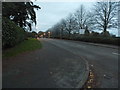
9
Coldharbour Road
A view along Coldharbour Road that runs through Pyrford towards West Byfleet. The junction on the left is Pyrford Heath, a short residential road, on the right is the cricket ground.
Image: © Alan Hunt
Taken: 20 Aug 2012
0.18 miles
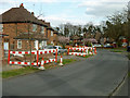
10
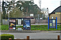
Bus stop and notice board, Coldharbour Road, Pyrford
A Woking Borough notice board. The bus stop is called Pyrford Village Hall, which is behind the camera.
Image: © Robin Webster
Taken: 20 Mar 2012
0.18 miles