IMAGES TAKEN NEAR TO
Lovelace Drive, WOKING, GU22 8QU
Introduction
This page details the photographs taken nearby to Lovelace Drive, GU22 8QU by members of the Geograph project.
The Geograph project started in 2005 with the aim of publishing, organising and preserving representative images for every square kilometre of Great Britain, Ireland and the Isle of Man.

There are currently over 7.5m images from over14,400 individuals and you can help contribute to the project by visiting https://www.geograph.org.uk
Image Map
Images are licensed for reuse under creativecommons.org/licenses/by-sa/2.0
Notes
- Clicking on the map will re-center to the selected point.
- The higher the marker number, the further away the image location is from the centre of the postcode.
Image Listing (15 Images Found)
Images are licensed for reuse under creativecommons.org/licenses/by-sa/2.0
Image
Details
Distance
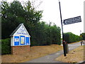
3
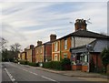
Townsend Cottages, Coldharbour Road, Pyrford
Five pairs of Victorian semis. A 'ghost sign' on the wall of the nearest would seem to indicate that the little shop was once a post office.
Image: © Stefan Czapski
Taken: 17 Apr 2013
0.10 miles
4
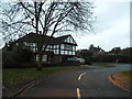
Coldharbour Road in Pyford
This road's name used to indicate the presence of a wayside shelter; provided for travellers without food or lodging.
Image: © Stuart Logan
Taken: 20 Apr 2012
0.11 miles
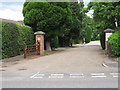
5
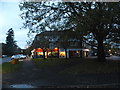
Church of the Good Shepherd, Pyrford: entrance
Image: © Basher Eyre
Taken: 14 Jul 2015
0.12 miles
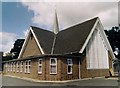
6

Church of the Good Shepherd, Pyrford: mid July 2015
Image: © Basher Eyre
Taken: 14 Jul 2015
0.14 miles
9
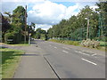
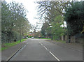
Coldharbour Road
A view along Coldharbour Road that runs through Pyrford towards West Byfleet. The junction on the left is Pyrford Heath, a short residential road, on the right is the cricket ground.
Image: © Alan Hunt
Taken: 20 Aug 2012
0.19 miles
10
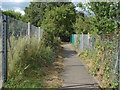
Footpath, Ridgway estate
The footpath from Coldharbour Road to the Ridgway estate that borders Pyrford Cricket Ground.
Image: © Alan Hunt
Taken: 20 Aug 2012
0.22 miles