IMAGES TAKEN NEAR TO
Roundhill, WOKING, GU22 8JB
Introduction
This page details the photographs taken nearby to Roundhill, GU22 8JB by members of the Geograph project.
The Geograph project started in 2005 with the aim of publishing, organising and preserving representative images for every square kilometre of Great Britain, Ireland and the Isle of Man.

There are currently over 7.5m images from over14,400 individuals and you can help contribute to the project by visiting https://www.geograph.org.uk
Image Map
Images are licensed for reuse under creativecommons.org/licenses/by-sa/2.0
Notes
- Clicking on the map will re-center to the selected point.
- The higher the marker number, the further away the image location is from the centre of the postcode.
Image Listing (18 Images Found)
Images are licensed for reuse under creativecommons.org/licenses/by-sa/2.0
Image
Details
Distance
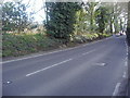
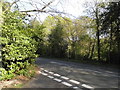
2
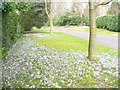
Knowl Hill
On the Hockering Estate, an exclusive area of upmarket residences, detached and hidden behind hedges. The wide grassy verge of the road here is carpeted with flowering crocuses.
Image: © Colin Smith
Taken: 1 Mar 2009
0.05 miles
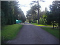
4
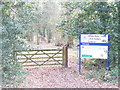
White Rose Lane Local Nature Reserve
Entry into the reserve from White Rose Lane, Woking. The reserve is on the banks of the River Hoe, a Wey tributary.
Image: © Colin Smith
Taken: 1 Mar 2009
0.14 miles
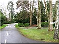
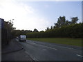
6
White Rose Lane at the junction of Clear Down
Image: © David Howard
Taken: 20 Apr 2015
0.17 miles
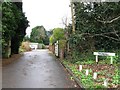
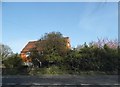
7
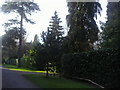
Hockering Road, Woking
The gardener has done a good job designing this scene
Image: © David Howard
Taken: 6 Mar 2011
0.18 miles