IMAGES TAKEN NEAR TO
Berry Lane, WOKING, GU22 0RH
Introduction
This page details the photographs taken nearby to Berry Lane, GU22 0RH by members of the Geograph project.
The Geograph project started in 2005 with the aim of publishing, organising and preserving representative images for every square kilometre of Great Britain, Ireland and the Isle of Man.

There are currently over 7.5m images from over14,400 individuals and you can help contribute to the project by visiting https://www.geograph.org.uk
Image Map
Images are licensed for reuse under creativecommons.org/licenses/by-sa/2.0
Notes
- Clicking on the map will re-center to the selected point.
- The higher the marker number, the further away the image location is from the centre of the postcode.
Image Listing (18 Images Found)
Images are licensed for reuse under creativecommons.org/licenses/by-sa/2.0
Image
Details
Distance
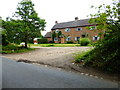
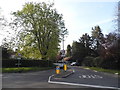
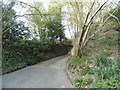
4
Saunders Lane at the junction of Blackhorse Road
Image: © David Howard
Taken: 20 Apr 2015
0.11 miles
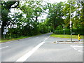
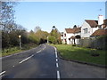
5
Blackhorse Road at the junction of Saunders Lane
Image: © David Howard
Taken: 20 Apr 2015
0.12 miles
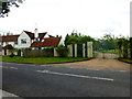
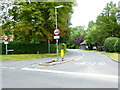
9
The entrance to Brae Rise on Berry Lane
Image: © David Howard
Taken: 20 Apr 2015
0.17 miles
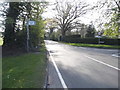
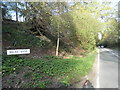
10
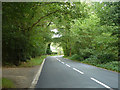
Blackhorse Road
The road seems to take its name not from a pub, but from a farm further along the road.
Image: © Robin Webster
Taken: 13 Sep 2014
0.19 miles