IMAGES TAKEN NEAR TO
Hook Heath Road, WOKING, GU22 0QF
Introduction
This page details the photographs taken nearby to Hook Heath Road, GU22 0QF by members of the Geograph project.
The Geograph project started in 2005 with the aim of publishing, organising and preserving representative images for every square kilometre of Great Britain, Ireland and the Isle of Man.

There are currently over 7.5m images from over14,400 individuals and you can help contribute to the project by visiting https://www.geograph.org.uk
Image Map
Images are licensed for reuse under creativecommons.org/licenses/by-sa/2.0
Notes
- Clicking on the map will re-center to the selected point.
- The higher the marker number, the further away the image location is from the centre of the postcode.
Image Listing (20 Images Found)
Images are licensed for reuse under creativecommons.org/licenses/by-sa/2.0
Image
Details
Distance
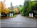
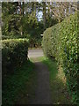
3
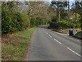
Hook Heath Road, Woking
The road with the tree lined edge of Hook Heath golf course on the left
Image: © Alan Hunt
Taken: 25 Mar 2011
0.11 miles
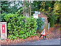
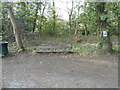
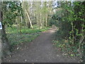
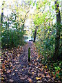
6
The western end of Mile Path with seat and traffic cones
Image: © Shazz
Taken: 16 Nov 2014
0.12 miles
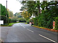
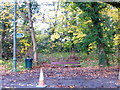
8
Fisher Lane, Woking
The north end of fisher Lane and the junction with Hook Heath Road
Image: © Alan Hunt
Taken: 25 Mar 2011
0.12 miles