IMAGES TAKEN NEAR TO
Hook Heath Road, WOKING, GU22 0QD
Introduction
This page details the photographs taken nearby to Hook Heath Road, GU22 0QD by members of the Geograph project.
The Geograph project started in 2005 with the aim of publishing, organising and preserving representative images for every square kilometre of Great Britain, Ireland and the Isle of Man.

There are currently over 7.5m images from over14,400 individuals and you can help contribute to the project by visiting https://www.geograph.org.uk
Image Map
Images are licensed for reuse under creativecommons.org/licenses/by-sa/2.0
Notes
- Clicking on the map will re-center to the selected point.
- The higher the marker number, the further away the image location is from the centre of the postcode.
Image Listing (18 Images Found)
Images are licensed for reuse under creativecommons.org/licenses/by-sa/2.0
Image
Details
Distance
1
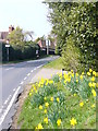
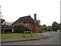
Hook Hill Lane
Suburban road in an upmarket area in south-west Woking.
Image: © Colin Smith
Taken: 21 Mar 2009
0.09 miles
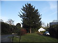
2
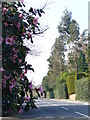
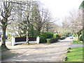
Hook Heath Road
Upmarker residential road in south-west Woking. Camellia blooms by the roadside, elsewhere are tall hedges.
Image: © Colin Smith
Taken: 21 Mar 2009
0.10 miles

5
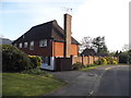
Mount Road
Upmarket residential road in south-west Woking. The large detached houses are mostly hidden behind hedges.
Image: © Colin Smith
Taken: 21 Mar 2009
0.16 miles
6
Hook Hill Park, Hook Heath
Been there done that. http://www.geograph.org.uk/photo/4439001 Woking is one of the hardest towns to navigate in Britain, second to Basingstoke.
Image: © David Howard
Taken: 5 Sep 2016
0.16 miles
7
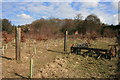
The southern slope of Hook Heath
Abandoned farm machinery on the slopes of Hook Heath.
Image: © Paul E Smith
Taken: 14 Mar 2010
0.16 miles
8
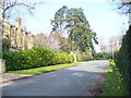
Pond Road
Residential road of desirable housing in south-west Woking. The road leads to Woking Golf Club - and the pond.
Image: © Colin Smith
Taken: 21 Mar 2009
0.17 miles
9
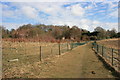
Footpath, Mayford
The fencing along this footpath is in a bad state of repair with many gaps and damaged areas.
Image: © Paul E Smith
Taken: 14 Mar 2010
0.17 miles
10
Garden on the corner of Hook Hill Park, Mayford
On the corner of Hook Hill Lane
Image: © David Howard
Taken: 20 Apr 2015
0.18 miles