IMAGES TAKEN NEAR TO
St. Johns Lye, WOKING, GU21 7SN
Introduction
This page details the photographs taken nearby to St. Johns Lye, GU21 7SN by members of the Geograph project.
The Geograph project started in 2005 with the aim of publishing, organising and preserving representative images for every square kilometre of Great Britain, Ireland and the Isle of Man.

There are currently over 7.5m images from over14,400 individuals and you can help contribute to the project by visiting https://www.geograph.org.uk
Image Map
Images are licensed for reuse under creativecommons.org/licenses/by-sa/2.0
Notes
- Clicking on the map will re-center to the selected point.
- The higher the marker number, the further away the image location is from the centre of the postcode.
Image Listing (98 Images Found)
Images are licensed for reuse under creativecommons.org/licenses/by-sa/2.0
Image
Details
Distance
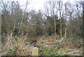
2
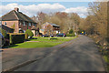
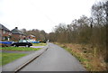
St John's Lye
Houses along St John's Lye, an access road in St John's village to the west of Woking.
Image: © Alan Hunt
Taken: 24 Feb 2016
0.03 miles
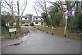
6
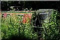
Basingstoke Canal
Canal narrow boat which, sadly, will not be cruising for some time.
Image: © Peter Trimming
Taken: 29 Jun 2019
0.07 miles