IMAGES TAKEN NEAR TO
Birch Close, WOKING, GU21 7PR
Introduction
This page details the photographs taken nearby to Birch Close, GU21 7PR by members of the Geograph project.
The Geograph project started in 2005 with the aim of publishing, organising and preserving representative images for every square kilometre of Great Britain, Ireland and the Isle of Man.

There are currently over 7.5m images from over14,400 individuals and you can help contribute to the project by visiting https://www.geograph.org.uk
Image Map
Images are licensed for reuse under creativecommons.org/licenses/by-sa/2.0
Notes
- Clicking on the map will re-center to the selected point.
- The higher the marker number, the further away the image location is from the centre of the postcode.
Image Listing (22 Images Found)
Images are licensed for reuse under creativecommons.org/licenses/by-sa/2.0
Image
Details
Distance
1
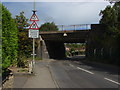
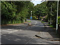
Triggs Lane
The railway bridge at the bottom end of Triggs Lane
Image: © Alan Hunt
Taken: 7 Aug 2011
0.05 miles
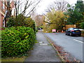
2
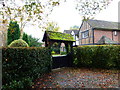
College Lane
The junction of College Lane with Cinder path.
Image: © Alan Hunt
Taken: 7 Aug 2011
0.06 miles
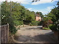
4
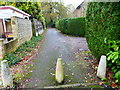
Cinder path, Woking
The access road that allows access to the houses to the east of Triggs Lane.
Image: © Alan Hunt
Taken: 7 Aug 2011
0.15 miles
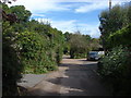
5
Triggs Close
Triggs Close from Triggs Lane
Image: © Alan Hunt
Taken: 7 Aug 2011
0.15 miles
6
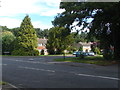
Triggs Lane, Woking
The top end of Triggs Lane, A major thoroughfare from Wych Hill to Goldsworth Park
Image: © Alan Hunt
Taken: 7 Aug 2011
0.16 miles
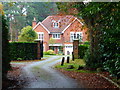
9
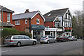
Shops on Wych Hill, Woking
The parade of shops on Wych Hill in the Hook Heath area of Woking. Many of the buildings in this area are late Victorian or Edwardian.
Image: © Alan Hunt
Taken: 10 Dec 2015
0.20 miles
10
Tree down on Beacon Hill (1)
For a view the other way see Image
Image: © Shazz
Taken: 16 Nov 2014
0.20 miles