IMAGES TAKEN NEAR TO
The Riding, WOKING, GU21 5TA
Introduction
This page details the photographs taken nearby to The Riding, GU21 5TA by members of the Geograph project.
The Geograph project started in 2005 with the aim of publishing, organising and preserving representative images for every square kilometre of Great Britain, Ireland and the Isle of Man.

There are currently over 7.5m images from over14,400 individuals and you can help contribute to the project by visiting https://www.geograph.org.uk
Image Map
Images are licensed for reuse under creativecommons.org/licenses/by-sa/2.0
Notes
- Clicking on the map will re-center to the selected point.
- The higher the marker number, the further away the image location is from the centre of the postcode.
Image Listing (96 Images Found)
Images are licensed for reuse under creativecommons.org/licenses/by-sa/2.0
Image
Details
Distance
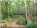
1
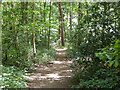
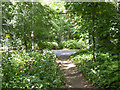
Path, Horsell Common
Towards All Saints Church, Woodham.
Image: © Robin Webster
Taken: 2 Aug 2020
0.12 miles
2
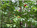
Rowan berries, Horsell Common
Some Chestnut leaves are also mixing in.
Image: © Robin Webster
Taken: 2 Aug 2020
0.12 miles
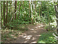
3
Path, Horsell Common
Towards All Saints Church, Woodham.
Image: © Robin Webster
Taken: 2 Aug 2020
0.12 miles
4
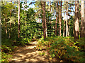
Path, Horsell Common
Heading south from Woodham Lane.
Image: © Robin Webster
Taken: 2 Aug 2020
0.12 miles
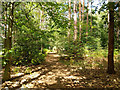
5
Path, Horsell Common
Towards All Saints Church, Woodham.
Image: © Robin Webster
Taken: 2 Aug 2020
0.13 miles
6
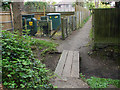
Path to Woodham Hall Estate
The footpath from Woodham Common past an electricity substation towards Woodham Hall Estate.
Image: © Alan Hunt
Taken: 27 Apr 2015
0.13 miles
7
Path, Horsell Common
Towards All Saints Church, Woodham.
Image: © Robin Webster
Taken: 2 Aug 2020
0.13 miles
9
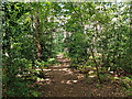
Path, Horsell Common
Nearing and crossing Woodham Lane.
Image: © Robin Webster
Taken: 2 Aug 2020
0.15 miles