
IMAGES TAKEN NEAR TO
Kingfisher Court, WOKING, GU21 5PT
Introduction
This page details the photographs taken nearby to Kingfisher Court, GU21 5PT by members of the Geograph project.
The Geograph project started in 2005 with the aim of publishing, organising and preserving representative images for every square kilometre of Great Britain, Ireland and the Isle of Man.

There are currently over 7.5m images from over14,400 individuals and you can help contribute to the project by visiting https://www.geograph.org.uk
Image Map
Images are licensed for reuse under creativecommons.org/licenses/by-sa/2.0
Notes
- Clicking on the map will re-center to the selected point.
- The higher the marker number, the further away the image location is from the centre of the postcode.
Image Listing (16 Images Found)
Images are licensed for reuse under creativecommons.org/licenses/by-sa/2.0
Image
Details
Distance
1

Basingstoke Canal and towpath at Sheerwater
Image: © David Martin
Taken: 14 May 2022
0.08 miles
2
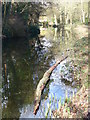
Log in the Basingstoke Canal
Tree trunk by the southern bank of the Basingstoke Canal at Sheerwater.
www.basingstoke-canal.co.uk
Image: © Colin Smith
Taken: 12 Feb 2011
0.10 miles
3
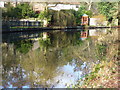
Reflections by Woodham Hall
Peaceful reach of the Basingstoke Canal to the north-east of Woking town centre.
www.basingstoke-canal.co.uk
Image: © Colin Smith
Taken: 12 Feb 2011
0.14 miles
4
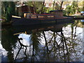
"White Heather" on the Basingstoke Canal
An old tug, built by J.S. Watson of Gainsborough, Lincolnshire in 1932 and bought by the London Borough of St Marylebone. It carried refuse.
www.basingstoke-canal.co.uk
Image: © Colin Smith
Taken: 12 Feb 2011
0.15 miles
5
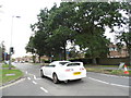
Albert Drive, Sheerwater
Sheerwater mainly consists of a council estate at the east side of the centre of Woking.
Image: © David Howard
Taken: 1 Sep 2013
0.17 miles
6
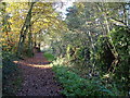
Basingstoke Canal, Sheerwater, Woking
Image: © David Griffiths
Taken: 10 Nov 2004
0.17 miles
7
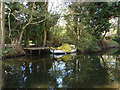
Basingstoke Canal
Old boat moored on the Woodham Hall Estate bank of the Basingstoke Canal
Image: © Alan Hunt
Taken: 20 Apr 2010
0.17 miles
8
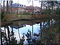
Basingstoke Canal by Woodham Hall
The canal here passes between contrasting residential areas of Woking.
www.basingstoke-canal.co.uk
Image: © Colin Smith
Taken: 12 Feb 2011
0.18 miles
9
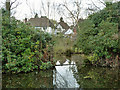
An intriguing backwater on the Basingstoke Canal
Running along behind the canal bank is a long pond, connected by two gaps in the bank to the canal. This gap is the northern one, the southern was missed, but is mapped to be about 80 m away. Surprisingly the pond is not recent. It appears on the 1871 map but without the cross-connections. It is unclear if it is navigable - there is a boom across this entrance. Several houses have the pond as an ornamental water at the bottom of their gardens.
Image: © Robin Webster
Taken: 18 Mar 2012
0.18 miles
10

Octimum Business Park, Sheerwater
Modern industrial estate, beside several others, in north-east Woking. This one has a more gobbledook name than most.
Image: © Colin Smith
Taken: 12 Feb 2011
0.19 miles