IMAGES TAKEN NEAR TO
Maybury Road, WOKING, GU21 5HX
Introduction
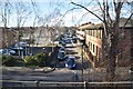
This page details the photographs taken nearby to Maybury Road, GU21 5HX by members of the Geograph project.
The Geograph project started in 2005 with the aim of publishing, organising and preserving representative images for every square kilometre of Great Britain, Ireland and the Isle of Man.

There are currently over 7.5m images from over14,400 individuals and you can help contribute to the project by visiting https://www.geograph.org.uk
Image Map
Images are licensed for reuse under creativecommons.org/licenses/by-sa/2.0
Notes
- Clicking on the map will re-center to the selected point.
- The higher the marker number, the further away the image location is from the centre of the postcode.
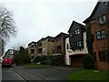
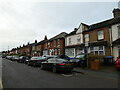
Image Listing (132 Images Found)
Images are licensed for reuse under creativecommons.org/licenses/by-sa/2.0
Image
Details
Distance

3
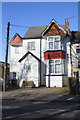
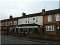
#106 Maybury Road
There is probably an Ordnance Survey cut mark benchmark on the left hand side of the house, about 5 feet from the front corner
Image: © Roger Templeman
Taken: 17 Feb 2015
0.03 miles
4
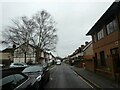
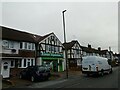
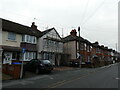
Looking from Maybury Road into North Road
Image: © Basher Eyre
Taken: 30 Dec 2021
0.04 miles