IMAGES TAKEN NEAR TO
Forsyth Road, WOKING, GU21 5FH
Introduction
This page details the photographs taken nearby to Forsyth Road, GU21 5FH by members of the Geograph project.
The Geograph project started in 2005 with the aim of publishing, organising and preserving representative images for every square kilometre of Great Britain, Ireland and the Isle of Man.

There are currently over 7.5m images from over14,400 individuals and you can help contribute to the project by visiting https://www.geograph.org.uk
Image Map
Images are licensed for reuse under creativecommons.org/licenses/by-sa/2.0
Notes
- Clicking on the map will re-center to the selected point.
- The higher the marker number, the further away the image location is from the centre of the postcode.
Image Listing (15 Images Found)
Images are licensed for reuse under creativecommons.org/licenses/by-sa/2.0
Image
Details
Distance
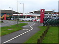
1
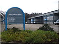
Scotswood Park, Sheerwater
One of several business parks in this commercial area of warehousing in north-east Woking.
Image: © Colin Smith
Taken: 12 Feb 2011
0.02 miles
2
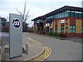
Genesis Business Park, Woking
Sheerwater, north-east Woking, has an agglomeration of small industrial estates with office blocks and warehousing.
Image: © Colin Smith
Taken: 12 Feb 2011
0.09 miles
3
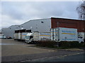
West Horsley Dairy
Not in West Horsley, but warehousing on a modern industrial estate in Sheerwater, Woking - some 10 kilometres north-west of West Horsley village.
www.westhorsleydairy.co.uk
Image: © Colin Smith
Taken: 12 Feb 2011
0.12 miles
4
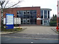
Octimum Business Park, Sheerwater
Another industrial estate with a contrived, gobbledegook name. This is one of several adjoining estates in north-east Woking and includes the West Horsley Dairy - though West Horsley village is some 10 kilometres away to the south-east.
Image: © Colin Smith
Taken: 12 Feb 2011
0.12 miles
5
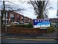
Octimum Business Park, Sheerwater
Modern industrial estate, beside several others, in north-east Woking. This one has a more gobbledook name than most.
Image: © Colin Smith
Taken: 12 Feb 2011
0.13 miles
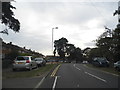
7
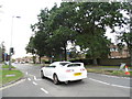
Albert Drive, Sheerwater
Sheerwater mainly consists of a council estate at the east side of the centre of Woking.
Image: © David Howard
Taken: 1 Sep 2013
0.16 miles
8
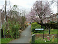
Dykes Path
This connects Albert Drive with Bentham Avenue on the Maybury Estate. I will say no more.
Image: © Robin Webster
Taken: 18 Mar 2012
0.18 miles
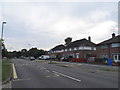
10
Albert Drive, Sheerwater
Through road with mixture of housing and industrial estates, on the north-east side of Woking. The car sales / garage, being on a main road, should get a good trade.
Image: © Colin Smith
Taken: 12 Feb 2011
0.19 miles