IMAGES TAKEN NEAR TO
Carthouse Lane, WOKING, GU21 4ZA
Introduction
This page details the photographs taken nearby to Carthouse Lane, GU21 4ZA by members of the Geograph project.
The Geograph project started in 2005 with the aim of publishing, organising and preserving representative images for every square kilometre of Great Britain, Ireland and the Isle of Man.

There are currently over 7.5m images from over14,400 individuals and you can help contribute to the project by visiting https://www.geograph.org.uk
Image Map
Images are licensed for reuse under creativecommons.org/licenses/by-sa/2.0
Notes
- Clicking on the map will re-center to the selected point.
- The higher the marker number, the further away the image location is from the centre of the postcode.
Image Listing (23 Images Found)
Images are licensed for reuse under creativecommons.org/licenses/by-sa/2.0
Image
Details
Distance
1
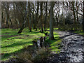
Horsell Common
View of the livestock gate at the western entrance of Horsell Common onto Carthouse Lane
Image: © Alan Hunt
Taken: 2 Apr 2010
0.03 miles
2
Carthouse Lane, Horsell
Looking north along Carthouse Lane from the path to Horsell Common. This lane is reputed to be haunted by a walking man carrying a rucksack.
Image: © Alan Hunt
Taken: 27 Apr 2016
0.05 miles
3
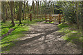
Cattle gate, Horsell Common
The cattle gate on the path from the common to Carthouse Lane.
Image: © Alan Hunt
Taken: 27 Apr 2016
0.10 miles
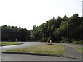
4
Horsell Birch
The short cul-de-sac off Claydon Road.
Image: © Alan Hunt
Taken: 17 Oct 2012
0.13 miles
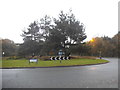
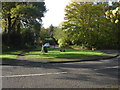
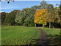
7
Goldsworth Park recreation ground
One of many maples in the park, this one in the northeastern corner.
Image: © Alan Hunt
Taken: 17 Oct 2012
0.15 miles
8
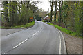
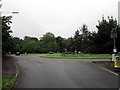
Roundabout on Littlewick Road, Horsell Birch
Overlooking Horsell Common which runs along the northern side of Woking
Image: © David Howard
Taken: 1 Sep 2013
0.16 miles
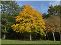
9
Goldsworth Park recreation ground
The tree line on the northeastern boundary of the recreation ground with the path going off to the Littlewick Road entrance.
Image: © Alan Hunt
Taken: 17 Oct 2012
0.16 miles
10
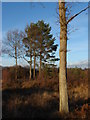
Horsell Birch
Trees on the part of Horsell Common known as Horsell Birch.
Image: © Alan Hunt
Taken: 30 Jan 2010
0.17 miles