
IMAGES TAKEN NEAR TO
Claydon Road, WOKING, GU21 4XE
Introduction
This page details the photographs taken nearby to Claydon Road, GU21 4XE by members of the Geograph project.
The Geograph project started in 2005 with the aim of publishing, organising and preserving representative images for every square kilometre of Great Britain, Ireland and the Isle of Man.

There are currently over 7.5m images from over14,400 individuals and you can help contribute to the project by visiting https://www.geograph.org.uk
Image Map
Images are licensed for reuse under creativecommons.org/licenses/by-sa/2.0
Notes
- Clicking on the map will re-center to the selected point.
- The higher the marker number, the further away the image location is from the centre of the postcode.
Image Listing (45 Images Found)
Images are licensed for reuse under creativecommons.org/licenses/by-sa/2.0
Image
Details
Distance
2
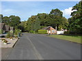
Claydon Road, Horsell
The small estate based on Claydon Road between Horsell Birch and Goldsworth Park.
Image: © Alan Hunt
Taken: 17 Oct 2012
0.06 miles
3
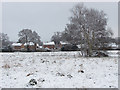
Houses near Horsell Birch
Looking northeast across the recreation area towards the houses on Claydon Road.
Image: © Alan Hunt
Taken: 3 Feb 2015
0.07 miles
4
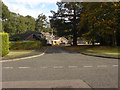
Tresta Walk, Horsell
Tresta Walk off Claydon Road, a small estate between Horsell Birch and Goldsworth Park.
Image: © Alan Hunt
Taken: 17 Oct 2012
0.07 miles
5
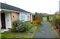
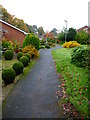
Looking out of path between dwellings to recreation ground
The dwellings are off Claydon Road.
Image: © Shazz
Taken: 16 Nov 2014
0.08 miles
6
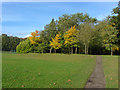
Goldsworth Park recreation ground
The wooded area on the northeastern boundary.
Image: © Alan Hunt
Taken: 17 Oct 2012
0.09 miles
7
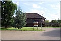
Goldwater Lodge
This building is Goldwater Lodge - specifically the part occupied by Toad Hall Nursery. The Community Hall is on the other side.
Image: © Ron Strutt
Taken: 29 Aug 2005
0.11 miles
8
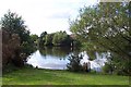
Goldsworth Park lake
The lake was created to drain what was a rather swampy area of ground so that it could be built on. The fact that it provided a community amenity was a by-product!
Image: © Ron Strutt
Taken: 29 Aug 2005
0.11 miles
9
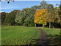
Goldsworth Park recreation ground
The tree line on the northeastern boundary of the recreation ground with the path going off to the Littlewick Road entrance.
Image: © Alan Hunt
Taken: 17 Oct 2012
0.12 miles
10
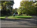
Horsell Birch
The short cul-de-sac off Claydon Road.
Image: © Alan Hunt
Taken: 17 Oct 2012
0.13 miles