IMAGES TAKEN NEAR TO
Russell Close, WOKING, GU21 4UX
Introduction
This page details the photographs taken nearby to Russell Close, GU21 4UX by members of the Geograph project.
The Geograph project started in 2005 with the aim of publishing, organising and preserving representative images for every square kilometre of Great Britain, Ireland and the Isle of Man.

There are currently over 7.5m images from over14,400 individuals and you can help contribute to the project by visiting https://www.geograph.org.uk
Image Map
Images are licensed for reuse under creativecommons.org/licenses/by-sa/2.0
Notes
- Clicking on the map will re-center to the selected point.
- The higher the marker number, the further away the image location is from the centre of the postcode.
Image Listing (22 Images Found)
Images are licensed for reuse under creativecommons.org/licenses/by-sa/2.0
Image
Details
Distance
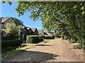
3
Viggory Lane, Horsell
This access road serves the houses along the southern edge of Horsell Birch, an area of heathland.
Image: © Alan Hunt
Taken: 2 Jul 2011
0.09 miles
4
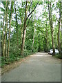
Viggory Lane, Horsell Birch
This is the west part of Horsell Common
Image: © David Howard
Taken: 1 Sep 2013
0.11 miles
5
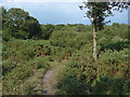
Horsell Birch
The area of heathland to the south of Littlewick Road is known as Horsell Birch. It is part of the much larger Horsell Common.
Image: © Alan Hunt
Taken: 2 Jul 2011
0.13 miles
6
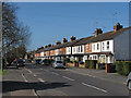
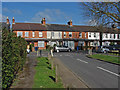
South Road, Horsell
An Edwardian terrace on South Road, Horsell. This was called Deep Lane in the 19th century when this area was covered by the fields of Thornash Farm.
Image: © Alan Hunt
Taken: 23 Apr 2013
0.13 miles
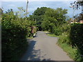
7
South Road, Horsell
A view along South Road towards Horsell Common. The side road in the foreground is Thornash Road.
Image: © Alan Hunt
Taken: 2 Jul 2011
0.13 miles
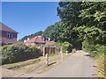
8
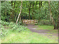
Way out, Horsell Common
There are rather new double gates at the boundaries of this part of the common, presumably for safely containing grazing animals, but none were seen.
Image: © Robin Webster
Taken: 4 Jun 2016
0.13 miles
9
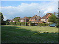
Horsell Birch
Houses along the southern edge of Horsell Birch.
Image: © Alan Hunt
Taken: 2 Jul 2011
0.14 miles
10
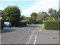
Thornash Way
The junction of Thornash Way with South Road. The buildings of Thornash Farm occupied the site where Thornash Road joins the High Street.
Image: © Alan Hunt
Taken: 23 Apr 2013
0.14 miles