
IMAGES TAKEN NEAR TO
Lydele Close, WOKING, GU21 4ER
Introduction
This page details the photographs taken nearby to Lydele Close, GU21 4ER by members of the Geograph project.
The Geograph project started in 2005 with the aim of publishing, organising and preserving representative images for every square kilometre of Great Britain, Ireland and the Isle of Man.

There are currently over 7.5m images from over14,400 individuals and you can help contribute to the project by visiting https://www.geograph.org.uk
Image Map
Images are licensed for reuse under creativecommons.org/licenses/by-sa/2.0
Notes
- Clicking on the map will re-center to the selected point.
- The higher the marker number, the further away the image location is from the centre of the postcode.
Image Listing (8 Images Found)
Images are licensed for reuse under creativecommons.org/licenses/by-sa/2.0
Image
Details
Distance
1
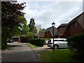
Horsell - The Pines of Woodham Road
Wellingtonia in background would indicate a stately home was nearby.
They were planted in the UK after 1853 - I expect this one to be around 1880 and is still a juvenile compare to its full potential.
Info : https://en.wikipedia.org/wiki/Sequoiadendron_giganteum
Image: © James Emmans
Taken: 20 May 2016
0.07 miles
3
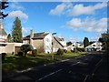
Woking - Brackendene Close
Detached houses could be 1970's.
Image: © James Emmans
Taken: 11 Feb 2018
0.17 miles
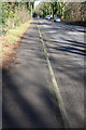
6
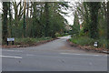
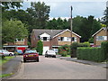
Castle Road, Horsell
The entrance to Castle Road off Shores Road.
Image: © Alan Hunt
Taken: 3 Feb 2016
0.23 miles
7
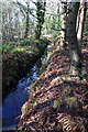
Looking west along Rive Ditch
At the end is a culvert taking the ditch under Chertsey Road (A320).
Image: © Roger Templeman
Taken: 17 Feb 2015
0.24 miles
8
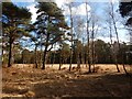
Trees on Horsell Common
Scott's Pine and Silver Birch in beautiful long grass.
Image: © James Emmans
Taken: 11 Feb 2018
0.24 miles