IMAGES TAKEN NEAR TO
Blencarn Close, WOKING, GU21 3RW
Introduction
This page details the photographs taken nearby to Blencarn Close, GU21 3RW by members of the Geograph project.
The Geograph project started in 2005 with the aim of publishing, organising and preserving representative images for every square kilometre of Great Britain, Ireland and the Isle of Man.

There are currently over 7.5m images from over14,400 individuals and you can help contribute to the project by visiting https://www.geograph.org.uk
Image Map
Images are licensed for reuse under creativecommons.org/licenses/by-sa/2.0
Notes
- Clicking on the map will re-center to the selected point.
- The higher the marker number, the further away the image location is from the centre of the postcode.
Image Listing (46 Images Found)
Images are licensed for reuse under creativecommons.org/licenses/by-sa/2.0
Image
Details
Distance
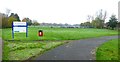
1
Goldsworth Park, Wishbone Way
The end of Wishbone Way as it approaches the recreation area car park.
Image: © Alan Hunt
Taken: 18 Apr 2013
0.04 miles
2
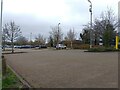
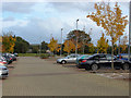
Goldsworth Park car park
The large car park at Goldsworth Park in Woking.
Image: © Oscar Taylor
Taken: 1 Apr 2023
0.07 miles
3
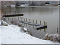
Goldsworth Park Lake
A wire-mesh run, possibly for fish stock management, on the north side of the lake.
Image: © Alan Hunt
Taken: 3 Feb 2015
0.08 miles
4
Goldsworth Park recreation ground
The car park next to the community hall and the play area north of the lake.
Image: © Alan Hunt
Taken: 17 Oct 2012
0.08 miles
5
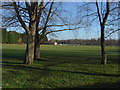
Goldsworth Park recreation ground
A view across the park from the path that borders the South-west edge
Image: © Alan Hunt
Taken: 15 Jan 2012
0.09 miles
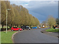
6
Goldsworth Park, Wishbone Way
A cul-de sac off Kirkland Avenue leading to the large recreation area around the lake.
Image: © Alan Hunt
Taken: 18 Apr 2013
0.09 miles
7
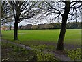
Goldsworth Park recreation ground
The recreation ground at Goldsworth Park, viewed from Wishbone Way.
Image: © Oscar Taylor
Taken: 1 Apr 2023
0.10 miles
8
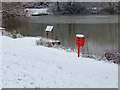
Lifebuoy, Goldsworth Park lake
A lifebuoy near one of the fishing jetties around the lake.
Image: © Alan Hunt
Taken: 3 Feb 2015
0.10 miles
9
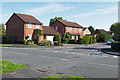
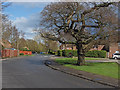
Watermead, Goldsworth Park
The junction of Watermead with Kirkland Avenue in this large late 1970s housing estate to the west of Woking.
Image: © Alan Hunt
Taken: 17 Sep 2015
0.10 miles