
IMAGES TAKEN NEAR TO
Huntingdon Road, WOKING, GU21 3JP
Introduction
This page details the photographs taken nearby to Huntingdon Road, GU21 3JP by members of the Geograph project.
The Geograph project started in 2005 with the aim of publishing, organising and preserving representative images for every square kilometre of Great Britain, Ireland and the Isle of Man.

There are currently over 7.5m images from over14,400 individuals and you can help contribute to the project by visiting https://www.geograph.org.uk
Image Map
Images are licensed for reuse under creativecommons.org/licenses/by-sa/2.0
Notes
- Clicking on the map will re-center to the selected point.
- The higher the marker number, the further away the image location is from the centre of the postcode.
Image Listing (25 Images Found)
Images are licensed for reuse under creativecommons.org/licenses/by-sa/2.0
Image
Details
Distance
2
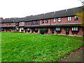
Terraced crescent of houses on Nethercote Avenue
Image: © Shazz
Taken: 16 Nov 2014
0.08 miles
4
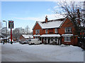
The Robin Hood , Knaphill
A pub on Robin Hood Road that would have been much used by the soldiers at the Inkerman Barracks which once occupied a site at the top of the hill above Robin Hood Road. The barracks went in the 1960's but the pub still thrives.
Image: © Alan Hunt
Taken: 9 Jan 2010
0.12 miles
5
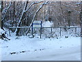
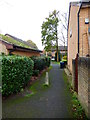
Footpath, Inkerman Woods
The bottom end of the footpath linking Robin Hood Road and Raglan Road, The site of the former Inkerman Barracks.
Image: © Alan Hunt
Taken: 9 Jan 2010
0.12 miles
8
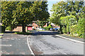
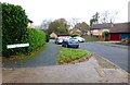
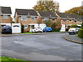
Tregarth Place, Goldsworth Park
A cul de sac off Kirkland Avenue in this large 1970s housing estate to the west of Woking.
Image: © Alan Hunt
Taken: 17 Sep 2015
0.15 miles
10
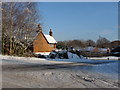
Locksley Drive, Knaphill
The Junction between Robin Hood Road and Locksley Drive. Locksley Drive was created in the 1980's to connect Knaphill and Woking and provide a feeder road for the Goldsworth Park Estate. Robin Hood Road used to connect the villages of Knaphill and St Johns but is now bisected by the St Johns bypass.
Image: © Alan Hunt
Taken: 9 Jan 2010
0.18 miles