
IMAGES TAKEN NEAR TO
Bankside, WOKING, GU21 3DY
Introduction
This page details the photographs taken nearby to Bankside, GU21 3DY by members of the Geograph project.
The Geograph project started in 2005 with the aim of publishing, organising and preserving representative images for every square kilometre of Great Britain, Ireland and the Isle of Man.

There are currently over 7.5m images from over14,400 individuals and you can help contribute to the project by visiting https://www.geograph.org.uk
Image Map
Images are licensed for reuse under creativecommons.org/licenses/by-sa/2.0
Notes
- Clicking on the map will re-center to the selected point.
- The higher the marker number, the further away the image location is from the centre of the postcode.
Image Listing (56 Images Found)
Images are licensed for reuse under creativecommons.org/licenses/by-sa/2.0
Image
Details
Distance
1

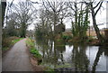
Basingstoke Canal towards Parley Drive
The first plans for the development of the Basingstoke Canal were drawn up in 1776, as a means to transport agricultural produce from central Hampshire. The Basingstoke Canal was completed in 1794 at a cost of £154,463 which was almost twice the estimated cost. From its junction with the River Wey Navigation at Byfleet, three miles from the Thames at Weybridge, the Canal was built to rise 195ft by 29 locks to Aldershot. Timber, flour and chalk were the principal cargoes to London. Barges returned with coal and fertiliser. Income though was never high and by the 1960s the Canal was virtually derelict.
Following a lengthy campaign for public ownership and restoration, the Basingstoke Canal Society set to work in 1976 to bring the Canal back to life. The Canal was finally opened in 1993 having taken 18 years to complete.
This is west of Langmans Lane and Parley Drive.
Image: © Marathon
Taken: 9 Nov 2025
0.02 miles
2
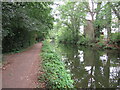
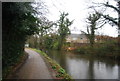
Basingstoke Canal, Woking
View of the canal near Parley Drive Bridge looking towards Woking
Image: © Richard Rogerson
Taken: 19 Aug 2021
0.02 miles
8
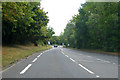
A324 Lockfield Drive
Towards central Woking.
Image: © Robin Webster
Taken: 2 Aug 2020
0.07 miles
10

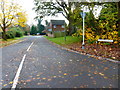
Basingstoke Canal west of Parley Drive
The first plans for the development of the Basingstoke Canal were drawn up in 1776, as a means to transport agricultural produce from central Hampshire. The Basingstoke Canal was completed in 1794 at a cost of £154,463 which was almost twice the estimated cost. From its junction with the River Wey Navigation at Byfleet, three miles from the Thames at Weybridge, the Canal was built to rise 195ft by 29 locks to Aldershot. Timber, flour and chalk were the principal cargoes to London. Barges returned with coal and fertiliser. Income though was never high and by the 1960s the Canal was virtually derelict.
Following a lengthy campaign for public ownership and restoration, the Basingstoke Canal Society set to work in 1976 to bring the Canal back to life. The Canal was finally opened in 1993 having taken 18 years to complete.
This is west of Parley Drive.
Image: © Marathon
Taken: 9 Nov 2025
0.07 miles