IMAGES TAKEN NEAR TO
Cobbetts Close, WOKING, GU21 3AJ
Introduction
This page details the photographs taken nearby to Cobbetts Close, GU21 3AJ by members of the Geograph project.
The Geograph project started in 2005 with the aim of publishing, organising and preserving representative images for every square kilometre of Great Britain, Ireland and the Isle of Man.

There are currently over 7.5m images from over14,400 individuals and you can help contribute to the project by visiting https://www.geograph.org.uk
Image Map
Images are licensed for reuse under creativecommons.org/licenses/by-sa/2.0
Notes
- Clicking on the map will re-center to the selected point.
- The higher the marker number, the further away the image location is from the centre of the postcode.
Image Listing (26 Images Found)
Images are licensed for reuse under creativecommons.org/licenses/by-sa/2.0
Image
Details
Distance
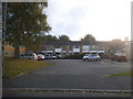
1
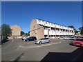
Flats in Cobbetts Close
Built in the 1970's as park of the large Goldsworthy Park estate development.
Image: © James Emmans
Taken: 1 Jun 2020
0.05 miles
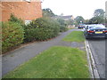
3
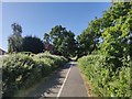
Cycle Path towards Sythwood
Joint footpath and cycle path.
Image: © James Emmans
Taken: 1 Jun 2020
0.10 miles
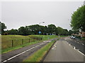
5
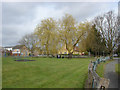
Sythwood, Goldsworth Park
Willows in the recreation area shielding the Salvation Army Hall on Sythwood.
Image: © Alan Hunt
Taken: 15 Apr 2013
0.13 miles
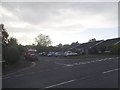
6
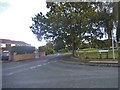
Sythwood at the junction of Bullbeggars Lane
Image: © David Howard
Taken: 16 Oct 2016
0.14 miles
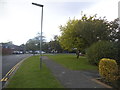
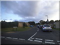
10
Roffords at the junction of Marston Road
Image: © David Howard
Taken: 16 Oct 2016
0.17 miles