IMAGES TAKEN NEAR TO
Chobham Road, WOKING, GU21 2TD
Introduction
This page details the photographs taken nearby to Chobham Road, GU21 2TD by members of the Geograph project.
The Geograph project started in 2005 with the aim of publishing, organising and preserving representative images for every square kilometre of Great Britain, Ireland and the Isle of Man.

There are currently over 7.5m images from over14,400 individuals and you can help contribute to the project by visiting https://www.geograph.org.uk
Image Map
Images are licensed for reuse under creativecommons.org/licenses/by-sa/2.0
Notes
- Clicking on the map will re-center to the selected point.
- The higher the marker number, the further away the image location is from the centre of the postcode.
Image Listing (34 Images Found)
Images are licensed for reuse under creativecommons.org/licenses/by-sa/2.0
Image
Details
Distance
2
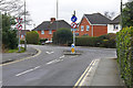
The Chobham Road, Knaphill
The junction of the Chobham Road with the A322, the Bagshot Road.
Image: © Alan Hunt
Taken: 20 Mar 2016
0.05 miles
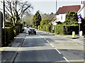
3
The Broadway, Knaphill
Looking northeast along the broadway from near the junction with the Bagshot Road.
Image: © Alan Hunt
Taken: 20 Mar 2016
0.11 miles
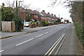
4
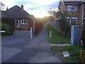
Path to Riverdene, Knaphill
This links the main A322 with the suburban roads behind on the edge of Bisley Common.
Image: © David Howard
Taken: 22 Feb 2009
0.12 miles