
IMAGES TAKEN NEAR TO
Oakwood Gardens, WOKING, GU21 2RX
Introduction
This page details the photographs taken nearby to Oakwood Gardens, GU21 2RX by members of the Geograph project.
The Geograph project started in 2005 with the aim of publishing, organising and preserving representative images for every square kilometre of Great Britain, Ireland and the Isle of Man.

There are currently over 7.5m images from over14,400 individuals and you can help contribute to the project by visiting https://www.geograph.org.uk
Image Map
Images are licensed for reuse under creativecommons.org/licenses/by-sa/2.0
Notes
- Clicking on the map will re-center to the selected point.
- The higher the marker number, the further away the image location is from the centre of the postcode.
Image Listing (29 Images Found)
Images are licensed for reuse under creativecommons.org/licenses/by-sa/2.0
Image
Details
Distance
1
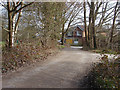
Track to Grindstone Crescent
The access road to the houses on the edge of Bisley Common with the houses on Grindstone Crescent at the end.
Image: © Alan Hunt
Taken: 11 Mar 2015
0.08 miles
2
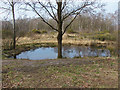
Small pond, Bisley Common
A small temporary pond on the common. These small ponds in shallow depressions will disappear over the summer.
Image: © Alan Hunt
Taken: 11 Mar 2015
0.09 miles
3
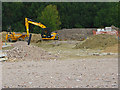
Brookwood Farm development, Knaphill
The early stages of this development started in 2014 to build 297 houses to the southwest of the existing houses along Coresbrook Way on the former Brookwood Farm. The plan includes a country park between the new development and Sheet's Heath.
Image: © Alan Hunt
Taken: 31 Jul 2014
0.11 miles
4
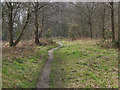
Bisley Common
A wooded area of the common near Grindstone Crescent.
Image: © Alan Hunt
Taken: 11 Mar 2015
0.11 miles
5
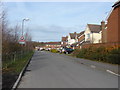
Coresbrook Way
New housing on Coresbrook Way, Knaphill.
Image: © Alan Hunt
Taken: 31 Jan 2010
0.13 miles
6
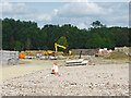
Brookwood Farm development
The early stages of the Brookwood Farm housing development in Knaphill. 297 houses are due to be built on the former fields of Brookwood Farm.
Image: © Alan Hunt
Taken: 31 Jul 2014
0.14 miles
7
Brokwood farm development
The site fence around the Brookwood Farm housing development in Knaphill.
Image: © Alan Hunt
Taken: 31 Jul 2014
0.15 miles
8
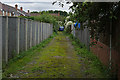
Alleyway off Sparvell Road
A narrow alleyway off Sparvell Road, Knaphill
Image: © Alan Hunt
Taken: 16 Sep 2015
0.15 miles
9
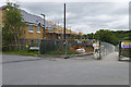
Brookwood Farm Estate
New housing under construction off Coresbrook Way in the new Brookwood Farm development.
Image: © Alan Hunt
Taken: 16 Sep 2015
0.17 miles
10
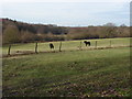
View towards Sheets Heath
View looking North-west towards Sheets Heath from Coresbrook Way
Image: © Alan Hunt
Taken: 31 Jan 2010
0.17 miles