
IMAGES TAKEN NEAR TO
Lorne Gardens, WOKING, GU21 2QL
Introduction
This page details the photographs taken nearby to Lorne Gardens, GU21 2QL by members of the Geograph project.
The Geograph project started in 2005 with the aim of publishing, organising and preserving representative images for every square kilometre of Great Britain, Ireland and the Isle of Man.

There are currently over 7.5m images from over14,400 individuals and you can help contribute to the project by visiting https://www.geograph.org.uk
Image Map
Images are licensed for reuse under creativecommons.org/licenses/by-sa/2.0
Notes
- Clicking on the map will re-center to the selected point.
- The higher the marker number, the further away the image location is from the centre of the postcode.
Image Listing (47 Images Found)
Images are licensed for reuse under creativecommons.org/licenses/by-sa/2.0
Image
Details
Distance
1
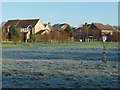
Brookwood Hospital Estate, Knaphill
The houses on the edge of the Brookwood Country Park on a frosty morning.
Image: © Alan Hunt
Taken: 29 Dec 2014
0.07 miles
2

Strathcona Gardens, Knaphill
Strathcona Gardens occupies part of the former Brookwood Mental Hospital site that was developed in the 1990's.
Image: © Alan Hunt
Taken: 29 Dec 2014
0.08 miles
4
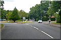
Hermitage Roundabout on A324
The A324 turns right here, towards central Woking.
Image: © Robin Webster
Taken: 2 Aug 2020
0.09 miles
5
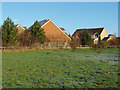
Brookwood Hospital Estate, Knaphill
The houses on the edge of Brookwood Country Park.
Image: © Alan Hunt
Taken: 29 Dec 2014
0.09 miles
6
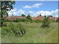
Brookwood Country Park
A view of the eastern end of the country park with the houses on Strathcona Gardens in the background.
Image: © Alan Hunt
Taken: 17 Jun 2012
0.11 miles
8

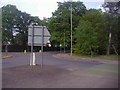
Dhammakaya Buddhist Temple, Knaphill
Formerly a chapel for Brookwood Mental Hospital
Image: © Basher Eyre
Taken: 21 May 2017
0.14 miles
9

Brookwood Hospital, Woking
Brookwood Hospital at Woking in Surrey, was established in 1867 by Surrey Quarter Sessions as the second County Asylum, the first being Springfield Asylum in Tooting. Since its closure in 1994 the land has been sold off for development for housing, and the Hospital's annexe block, which is listed, has been converted into luxury apartments. Several of the new residential roads were named after the old hospital wards. The hospital's chapel is now a Buddhist temple and the former mortuary now provides living accommodation for the temple's monks. This photo was taken from the Chobham Ridges using a Celestron 21035 Telescope at X10 magnification with a Nokia C3 mobile phone against the eyepiece. Note, The objects in the foreground are targets at the Bisley rifle range.
Image: © Len Williams
Taken: 17 Dec 2012
0.14 miles
10
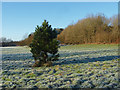
Pine tree, Brookwood Country Park
A recently planted pine in the large open area of the park.
Image: © Alan Hunt
Taken: 29 Dec 2014
0.14 miles