IMAGES TAKEN NEAR TO
Mint Walk, WOKING, GU21 2NT
Introduction
This page details the photographs taken nearby to Mint Walk, GU21 2NT by members of the Geograph project.
The Geograph project started in 2005 with the aim of publishing, organising and preserving representative images for every square kilometre of Great Britain, Ireland and the Isle of Man.

There are currently over 7.5m images from over14,400 individuals and you can help contribute to the project by visiting https://www.geograph.org.uk
Image Map
Images are licensed for reuse under creativecommons.org/licenses/by-sa/2.0
Notes
- Clicking on the map will re-center to the selected point.
- The higher the marker number, the further away the image location is from the centre of the postcode.
Image Listing (20 Images Found)
Images are licensed for reuse under creativecommons.org/licenses/by-sa/2.0
Image
Details
Distance
1
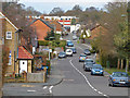
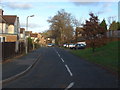
Semper Close, Knaphill
One of the side roads off Creston Avenue.
Image: © Alan Hunt
Taken: 14 Apr 2013
0.05 miles
2
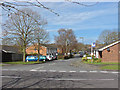
Lower Knaphill
A view along Robin Hood Road which becomes Barnby Road near the red brick gable. The parade of shops on Anchor Hill are in the far background.
Image: © Alan Hunt
Taken: 14 Apr 2013
0.10 miles
3
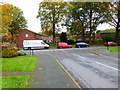
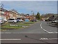
Creston Avenue
The housing estates around Creston Avenue were built during the mid 1970s. There are allotments to the left of where the bus is stopped.
Image: © Alan Hunt
Taken: 14 Apr 2013
0.11 miles
4
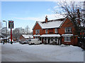
The Robin Hood , Knaphill
A pub on Robin Hood Road that would have been much used by the soldiers at the Inkerman Barracks which once occupied a site at the top of the hill above Robin Hood Road. The barracks went in the 1960's but the pub still thrives.
Image: © Alan Hunt
Taken: 9 Jan 2010
0.18 miles
5
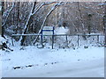
Footpath, Inkerman Woods
The bottom end of the footpath linking Robin Hood Road and Raglan Road, The site of the former Inkerman Barracks.
Image: © Alan Hunt
Taken: 9 Jan 2010
0.18 miles
6
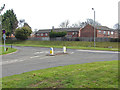
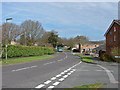
Lockfield Drive
The junction of Creston Avenue with Lockfield Drive.
Image: © Alan Hunt
Taken: 14 Apr 2013
0.19 miles
7
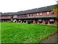
Terraced crescent of houses on Nethercote Avenue
Image: © Shazz
Taken: 16 Nov 2014
0.20 miles
8
Mulgrave Way, Knaphill
The cul de sac which runs from Victoria road along the back of what used to be the Army storage depot (now demolished) on Raglan Road.
Image: © Alan Hunt
Taken: 7 Jan 2012
0.21 miles
9
Chequer Tree Close
This close built during the 1970s from the junction with Creston Avenue.
Image: © Alan Hunt
Taken: 14 Apr 2013
0.21 miles