IMAGES TAKEN NEAR TO
Northwood Avenue, WOKING, GU21 2ET
Introduction
This page details the photographs taken nearby to Northwood Avenue, GU21 2ET by members of the Geograph project.
The Geograph project started in 2005 with the aim of publishing, organising and preserving representative images for every square kilometre of Great Britain, Ireland and the Isle of Man.

There are currently over 7.5m images from over14,400 individuals and you can help contribute to the project by visiting https://www.geograph.org.uk
Image Map
Images are licensed for reuse under creativecommons.org/licenses/by-sa/2.0
Notes
- Clicking on the map will re-center to the selected point.
- The higher the marker number, the further away the image location is from the centre of the postcode.
Image Listing (40 Images Found)
Images are licensed for reuse under creativecommons.org/licenses/by-sa/2.0
Image
Details
Distance
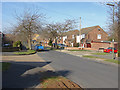
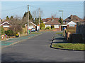
1
Burnham Road, Knaphill
A cul-de sac in the 1960s housing estate between Victoria Road and Lower Guildford Road.
Image: © Alan Hunt
Taken: 11 Mar 2015
0.06 miles
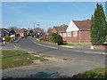
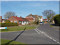
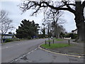
3
Northwood Avenue, Knaphill
Looking west along Northwood Avenue with the Southwood Avenue junction on the left.
Image: © Alan Hunt
Taken: 11 Mar 2015
0.08 miles
4
Burnham Road, Knaphill
The junction of Burnham Road with Inkerman Road.
Image: © Alan Hunt
Taken: 11 Mar 2015
0.11 miles
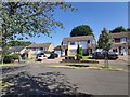
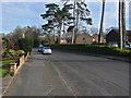
5
Clinton Close, Knaphill
Clinton Close from the junction with Burnham Road.
Image: © Alan Hunt
Taken: 11 Mar 2015
0.12 miles
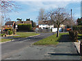
6
Inkerman Road, Knaphill
Looking north along Inkerman road towards the junction with Victoria Road. Burnham Road is on the left.
Image: © Alan Hunt
Taken: 11 Mar 2015
0.13 miles
7
Inkerman Road, Knaphill
Inkerman Road, a residential road off Hermitage Road. The name comes from the Inkerman Barracks which occupied a nearby site until the 1970s.
Image: © Alan Hunt
Taken: 11 Mar 2015
0.14 miles
9
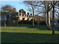
Wellington Terrace, Knaphill
The northern end of Wellington Terrace from the green on Victoria Road.
Image: © Alan Hunt
Taken: 14 Jan 2012
0.17 miles
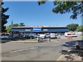
10
Haring round the Hermitage (29)
Junction of Five Oaks Close and Hermitage Road
Image: © Basher Eyre
Taken: 20 Mar 2017
0.17 miles