IMAGES TAKEN NEAR TO
Mill Pond Road, WINDLESHAM, GU20 6JT
Introduction
This page details the photographs taken nearby to Mill Pond Road, GU20 6JT by members of the Geograph project.
The Geograph project started in 2005 with the aim of publishing, organising and preserving representative images for every square kilometre of Great Britain, Ireland and the Isle of Man.

There are currently over 7.5m images from over14,400 individuals and you can help contribute to the project by visiting https://www.geograph.org.uk
Image Map
Images are licensed for reuse under creativecommons.org/licenses/by-sa/2.0
Notes
- Clicking on the map will re-center to the selected point.
- The higher the marker number, the further away the image location is from the centre of the postcode.
Image Listing (6 Images Found)
Images are licensed for reuse under creativecommons.org/licenses/by-sa/2.0
Image
Details
Distance
1
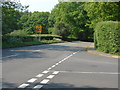
School Lane, Windlesham
The B386, School Lane from its junction with Snow Ride (on the right)
Image: © Alan Hunt
Taken: 30 Apr 2011
0.13 miles
2
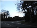
School Road at the junction of Snows Ride
Image: © David Howard
Taken: 1 Feb 2015
0.17 miles
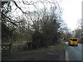
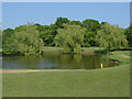
4
Windlesham Golf Course
A view from the footpath looking bach at the smaller of the two lakes on the course
Image: © Alan Hunt
Taken: 30 Apr 2011
0.23 miles
5
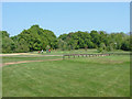
Windlesham Golf Course
The greens from the footpath from School Lane
Image: © Alan Hunt
Taken: 30 Apr 2011
0.24 miles
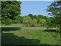
6
Windlesham Golf Course
A small lake/golf ball magnet near the footpath from School lane
Image: © Alan Hunt
Taken: 30 Apr 2011
0.25 miles