IMAGES TAKEN NEAR TO
Woodlands Lane, WINDLESHAM, GU20 6AP
Introduction
This page details the photographs taken nearby to Woodlands Lane, GU20 6AP by members of the Geograph project.
The Geograph project started in 2005 with the aim of publishing, organising and preserving representative images for every square kilometre of Great Britain, Ireland and the Isle of Man.

There are currently over 7.5m images from over14,400 individuals and you can help contribute to the project by visiting https://www.geograph.org.uk
Image Map
Images are licensed for reuse under creativecommons.org/licenses/by-sa/2.0
Notes
- Clicking on the map will re-center to the selected point.
- The higher the marker number, the further away the image location is from the centre of the postcode.
Image Listing (43 Images Found)
Images are licensed for reuse under creativecommons.org/licenses/by-sa/2.0
Image
Details
Distance
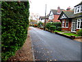
1
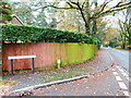
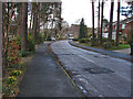
Woodlands Lane, Windlesham
Woodlands Lane with the junction of Heathpark Drive on the left.
Image: © Alan Hunt
Taken: 20 Feb 2014
0.06 miles
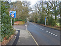
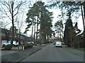
3
Heathpark Drive, Windlesham
The pine tree lined road developed during the late 1960s on former heathland.
Image: © Alan Hunt
Taken: 20 Feb 2014
0.11 miles
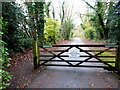
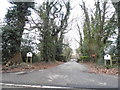
4
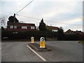
Updown Hill at the junction of Thorndown Lane
Image: © David Howard
Taken: 1 Feb 2015
0.12 miles
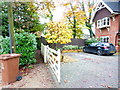
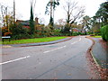
8
The entrance to Twelve Oaks on Woodlands Lane
Image: © David Howard
Taken: 1 Feb 2015
0.14 miles