IMAGES TAKEN NEAR TO
Macdonald Road, LIGHTWATER, GU18 5YA
Introduction
This page details the photographs taken nearby to Macdonald Road, GU18 5YA by members of the Geograph project.
The Geograph project started in 2005 with the aim of publishing, organising and preserving representative images for every square kilometre of Great Britain, Ireland and the Isle of Man.

There are currently over 7.5m images from over14,400 individuals and you can help contribute to the project by visiting https://www.geograph.org.uk
Image Map
Images are licensed for reuse under creativecommons.org/licenses/by-sa/2.0
Notes
- Clicking on the map will re-center to the selected point.
- The higher the marker number, the further away the image location is from the centre of the postcode.
Image Listing (8 Images Found)
Images are licensed for reuse under creativecommons.org/licenses/by-sa/2.0
Image
Details
Distance
1
Ambleside Road, Lightwater
The western end of this long straight road that runs from the village centre westward to Macdonald Road, a distance of 1.4km.
Image: © Alan Hunt
Taken: 20 Jan 2014
0.15 miles
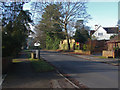
2
Macdonald Road
Macdonald Road looking towards the junction with Curley Hill Road on the left.
Image: © Alan Hunt
Taken: 20 Jan 2014
0.17 miles
3
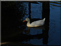
A Duck
A duck on the small lake at Lightwater Country Park.
Image: © Alan Hunt
Taken: 22 May 2010
0.21 miles
4
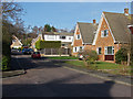
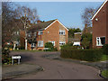
Gale Drive
Gale Drive from Aplin Road. This area mostly dates from the 1960s.
Image: © Alan Hunt
Taken: 20 Jan 2014
0.21 miles
5
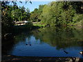
Lightwater Country Park
The smallest of the three lakes near the entrance to the park
Image: © Alan Hunt
Taken: 22 May 2010
0.23 miles
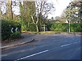
6
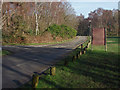
Recreation centre access road
The road from the Avenue to Lightwater country park and the recreation centre.
Image: © Alan Hunt
Taken: 20 Jan 2014
0.24 miles
7
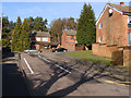
Badger Drive
The north end of Badger Drive where it meets The Avenue.
Image: © Alan Hunt
Taken: 20 Jan 2014
0.24 miles
8
Birch Tree View
Birch Tree View from the junction with Aplin Road.
Image: © Alan Hunt
Taken: 20 Jan 2014
0.24 miles