IMAGES TAKEN NEAR TO
Blackstroud Lane East, LIGHTWATER, GU18 5XR
Introduction
This page details the photographs taken nearby to Blackstroud Lane East, GU18 5XR by members of the Geograph project.
The Geograph project started in 2005 with the aim of publishing, organising and preserving representative images for every square kilometre of Great Britain, Ireland and the Isle of Man.

There are currently over 7.5m images from over14,400 individuals and you can help contribute to the project by visiting https://www.geograph.org.uk
Image Map (Loading...)


Getting Data...Please wait
Leaflet Map data © OpenStreetMap
Images are licensed for reuse under creativecommons.org/licenses/by-sa/2.0
Notes
- Clicking on the map will re-center to the selected point.
- The higher the marker number, the further away the image location is from the centre of the postcode.
Image Listing (16 Images Found)
Images are licensed for reuse under creativecommons.org/licenses/by-sa/2.0
Image
Details
Distance
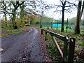
2
Burnt Pollard Road
The bridge over the Hale Bourne.
Image: © Alan Hunt
Taken: 24 Mar 2011
0.19 miles
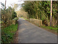
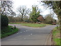
3
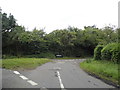
Burnt Pollard Lane
The junction between Burnt Pollard Lane and Blackstroud Lane.
Image: © Alan Hunt
Taken: 24 Mar 2011
0.20 miles

5
Flooding on Hook Mill Lane
The small stream that usually runs beside Hook Mill Lane and down Burnt Pollard Lane has burst its banks with the heavy rain this week and is causing a 'river' to form along the Burnt Pollard Lane Image Perhaps not the best time to be trying to sell your house!
Image: © Oscar Taylor
Taken: 1 Apr 2023
0.22 miles
6
Hook Mill Lane at the junction of Burnt Pollard Lane
Image: © David Howard
Taken: 27 Jul 2015
0.22 miles
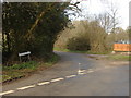
8
Burnt Pollard Lane
The junction between Burnt Pollard Lane and Rye Grove. The entrance to Manor Farm can be seen opposite the junction.
Image: © Alan Hunt
Taken: 24 Mar 2011
0.22 miles
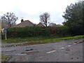
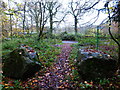
9
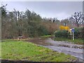
Grass island at the north end of Burnt Pollard Lane
This is seen in 2011 from another angle at http://www.geograph.org.uk/photo/2324229.
Image: © Shazz
Taken: 27 Nov 2014
0.23 miles
10
Flooding on Burnt Pollard Lane
The small stream that usually runs beside Burnt Pollard Lane has burst its banks with the heavy rain this week and is causing a 'river' to form along the lane. Perhaps not the best time to be trying to sell your house!
Image: © Oscar Taylor
Taken: 1 Apr 2023
0.23 miles