
IMAGES TAKEN NEAR TO
Macdonald Road, LIGHTWATER, GU18 5US
Introduction
This page details the photographs taken nearby to Macdonald Road, GU18 5US by members of the Geograph project.
The Geograph project started in 2005 with the aim of publishing, organising and preserving representative images for every square kilometre of Great Britain, Ireland and the Isle of Man.

There are currently over 7.5m images from over14,400 individuals and you can help contribute to the project by visiting https://www.geograph.org.uk
Image Map
Images are licensed for reuse under creativecommons.org/licenses/by-sa/2.0
Notes
- Clicking on the map will re-center to the selected point.
- The higher the marker number, the further away the image location is from the centre of the postcode.
Image Listing (30 Images Found)
Images are licensed for reuse under creativecommons.org/licenses/by-sa/2.0
Image
Details
Distance
5
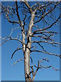
Dead tree, Pirbright Ranges
I had to capture the silver sheen of this tree against the pure blue sky. It almost looks as if it is made from brushed aluminium.
Image: © Alan Hunt
Taken: 18 Jul 2010
0.14 miles
6
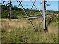
Pirbright Ranges
Grass growing around the base of one of the pylons. This is typical Grayling (Hipparcia semele) territory and indeed there were many on the wing in this area.
Image: © Alan Hunt
Taken: 18 Jul 2010
0.14 miles
7
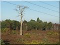
The silver tree, Pirbright Range
A long dead pine on the main track north of the Pirbright range fence.
Image: © Alan Hunt
Taken: 19 Jan 2015
0.15 miles
8
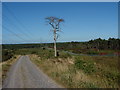
Pirbright Ranges
View across the Folly Bog from the high ground to the west. This dead tree had acquired a wonderful silver sheen from the effects of the elements.
Image: © Alan Hunt
Taken: 18 Jul 2010
0.15 miles
9
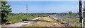
ISON Viewing Location
Comet ISON (International Scientific Optical Network) will be visible at the end of 2013. This photo shows a prospective viewing site to see the conjunction with Mars (September 29th) and best tail view (November 25th). The comet will be seen just before dawn in the East, which is to the right of the power lines. For this view taken at night on the 7th October 2014 refer to picture Image
Image: © Len Williams
Taken: 5 Sep 2013
0.15 miles
10
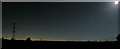
London Skyline in Moonlight
This view of the London Skyline has Heathrow Airport in the middle - left of the picture. The bright lights on the right are those of Woking. For a closer view refer to picture Image For this view taken in the daylight refer to picture Image
Image: © Len Williams
Taken: 7 Oct 2014
0.16 miles