IMAGES TAKEN NEAR TO
Hawley Road, CAMBERLEY, GU17 9EP
Introduction
This page details the photographs taken nearby to Hawley Road, GU17 9EP by members of the Geograph project.
The Geograph project started in 2005 with the aim of publishing, organising and preserving representative images for every square kilometre of Great Britain, Ireland and the Isle of Man.

There are currently over 7.5m images from over14,400 individuals and you can help contribute to the project by visiting https://www.geograph.org.uk
Image Map (Loading...)


Getting Data...Please wait
Leaflet Map data © OpenStreetMap
Images are licensed for reuse under creativecommons.org/licenses/by-sa/2.0
Notes
- Clicking on the map will re-center to the selected point.
- The higher the marker number, the further away the image location is from the centre of the postcode.
Image Listing (395 Images Found)
Images are licensed for reuse under creativecommons.org/licenses/by-sa/2.0
Image
Details
Distance
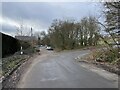
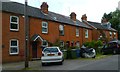
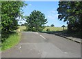
2
Once was Hawley Road
At some point in the 1970s the road was realigned.
Image: © Fernweh
Taken: 8 Jun 2015
0.02 miles
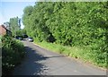
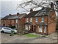
4
Original alignment of Hawley Road
The road to the right is not part of the original road.
Image: © Fernweh
Taken: 2 Feb 2023
0.03 miles
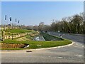
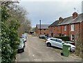
8
New drains - Hawley Road
See Image for a similar view taken in a different season.
Image: © Fernweh
Taken: 19 Jan 2023
0.03 miles
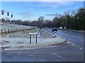
9
Old Hawley Road joins Hawley Road
The original alignment was changed many years ago.
Image: © Fernweh
Taken: 8 Jun 2015
0.04 miles
10
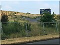
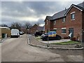
You have been warned
More fields lost to houses.
Image: © Fernweh
Taken: 12 Jun 2020
0.04 miles