IMAGES TAKEN NEAR TO
St. Catherines Road, CAMBERLEY, GU16 9NN
Introduction
This page details the photographs taken nearby to St. Catherines Road, GU16 9NN by members of the Geograph project.
The Geograph project started in 2005 with the aim of publishing, organising and preserving representative images for every square kilometre of Great Britain, Ireland and the Isle of Man.

There are currently over 7.5m images from over14,400 individuals and you can help contribute to the project by visiting https://www.geograph.org.uk
Image Map (Loading...)


Getting Data...Please wait
Leaflet Map data © OpenStreetMap
Images are licensed for reuse under creativecommons.org/licenses/by-sa/2.0
Notes
- Clicking on the map will re-center to the selected point.
- The higher the marker number, the further away the image location is from the centre of the postcode.
Image Listing (13 Images Found)
Images are licensed for reuse under creativecommons.org/licenses/by-sa/2.0
Image
Details
Distance
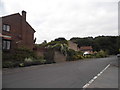
1
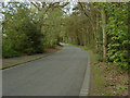
St Catherine Road, Frimley
This road runs alongside the Frith Hill military estates (on the right).
Image: © Alan Hunt
Taken: 17 Apr 2011
0.08 miles
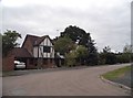
2
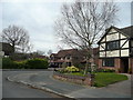
Lansdowne Road, Frimley Green
A neat neighbourhood of 1980's Mock Tudor.
Image: © Jonathan Billinger
Taken: 26 Mar 2008
0.10 miles
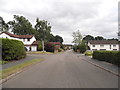
5
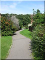
Footpath from Pevensey Way to St. Catherine's Road
This path provides a useful access connecting Balmoral Drive to St. Catherine's Road (via Pevensey Way).
Image: © don cload
Taken: 31 Aug 2011
0.11 miles
7
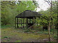
Frith Hill
Derelict workshop, possibly of military origin on the edge of the Frith Hill training area.
Image: © Alan Hunt
Taken: 17 Apr 2011
0.17 miles
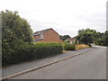
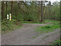
8
Woods Next to St Catherines Road, Frimley
Frimley is very developed but these woods are quite unspoilt despite having named 'roads' in them.
Image: © Graham Clutton
Taken: 5 Jan 2006
0.17 miles
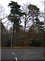
10
Frith Hill
The north-south track that marks the boundary with the MOD training area looking towards the junction with Valley Road. On the left are the MOD warning boards.
Image: © Alan Hunt
Taken: 17 Apr 2011
0.18 miles