IMAGES TAKEN NEAR TO
Essex Close, CAMBERLEY, GU16 9FH
Introduction
This page details the photographs taken nearby to Essex Close, GU16 9FH by members of the Geograph project.
The Geograph project started in 2005 with the aim of publishing, organising and preserving representative images for every square kilometre of Great Britain, Ireland and the Isle of Man.

There are currently over 7.5m images from over14,400 individuals and you can help contribute to the project by visiting https://www.geograph.org.uk
Image Map
Images are licensed for reuse under creativecommons.org/licenses/by-sa/2.0
Notes
- Clicking on the map will re-center to the selected point.
- The higher the marker number, the further away the image location is from the centre of the postcode.
Image Listing (11 Images Found)
Images are licensed for reuse under creativecommons.org/licenses/by-sa/2.0
Image
Details
Distance
1
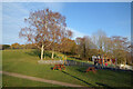
Hill in the Park
Rising to a height of 94 metres, this is the steeper northern part of a park which slopes down to flat playing fields in the southern half.
Image: © Des Blenkinsopp
Taken: 7 Dec 2022
0.12 miles
2
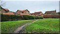
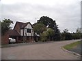
Frimley - Houses in Ludlow Close
Footpath from the Recreation Ground going pass a pond.
Image: © James Emmans
Taken: 6 Jan 2022
0.16 miles
5
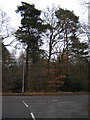
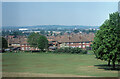
Woods Next to St Catherines Road, Frimley
Frimley is very developed but these woods are quite unspoilt despite having named 'roads' in them.
Image: © Graham Clutton
Taken: 5 Jan 2006
0.18 miles
7
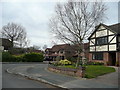
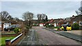
Lansdowne Road, Frimley Green
A neat neighbourhood of 1980's Mock Tudor.
Image: © Jonathan Billinger
Taken: 26 Mar 2008
0.21 miles
8
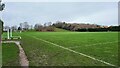
Recreation Ground
Large green area near Beresford Close.
Image: © James Emmans
Taken: 6 Jan 2022
0.21 miles
9
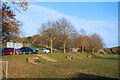
Frimley Green Recreation Ground
A break of slope separates the two sections of the park, where the southern half has been levelled out for playing fields while the northern part rises up to a small wooded summit at 94 metres aod.
Image: © Des Blenkinsopp
Taken: 7 Dec 2022
0.21 miles