
IMAGES TAKEN NEAR TO
White Wood Vale, CAMBERLEY, GU16 9AG
Introduction
This page details the photographs taken nearby to White Wood Vale, GU16 9AG by members of the Geograph project.
The Geograph project started in 2005 with the aim of publishing, organising and preserving representative images for every square kilometre of Great Britain, Ireland and the Isle of Man.

There are currently over 7.5m images from over14,400 individuals and you can help contribute to the project by visiting https://www.geograph.org.uk
Image Map
Images are licensed for reuse under creativecommons.org/licenses/by-sa/2.0
Notes
- Clicking on the map will re-center to the selected point.
- The higher the marker number, the further away the image location is from the centre of the postcode.
Image Listing (4 Images Found)
Images are licensed for reuse under creativecommons.org/licenses/by-sa/2.0
Image
Details
Distance
1
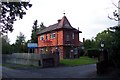
Ridgewood Centre
The picture shows the lodge of the Ridgewood Centre, a unit run by the Surrey and Borders Partnership NHS Trust, a specialist NHS Trust providing the mental health, including drug and alcohol services, child and adolescent mental health and specialist learning disabilities services to the people of Surrey, Croydon and north east Hampshire. The site provides residential mental health care for the area.
Image: © Ron Strutt
Taken: 29 Sep 2005
0.08 miles
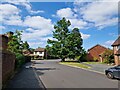
3
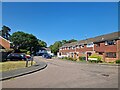
Navigating northwards up the Basher (26)
Houses in Coniston Close
Image: © Basher Eyre
Taken: 5 Jun 2023
0.21 miles
4
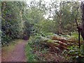
Shady path
The public bridleway passes through the woodland that lies between two halves of Pine Ridge golf course.
Image: © don cload
Taken: 8 Sep 2011
0.23 miles