IMAGES TAKEN NEAR TO
Melville Avenue, CAMBERLEY, GU16 8NA
Introduction
This page details the photographs taken nearby to Melville Avenue, GU16 8NA by members of the Geograph project.
The Geograph project started in 2005 with the aim of publishing, organising and preserving representative images for every square kilometre of Great Britain, Ireland and the Isle of Man.

There are currently over 7.5m images from over14,400 individuals and you can help contribute to the project by visiting https://www.geograph.org.uk
Image Map
Images are licensed for reuse under creativecommons.org/licenses/by-sa/2.0
Notes
- Clicking on the map will re-center to the selected point.
- The higher the marker number, the further away the image location is from the centre of the postcode.
Image Listing (13 Images Found)
Images are licensed for reuse under creativecommons.org/licenses/by-sa/2.0
Image
Details
Distance
1
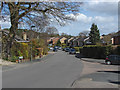
Alphington Avenue, Frimley
Looking east along Alphington Avenue, one of the thoroughfares in the 1970s estates on the heaths to the east of Frimley.
Image: © Alan Hunt
Taken: 16 Apr 2013
0.07 miles
2
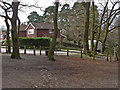
Alphington Avenue, Frimley
The right angle bend in Alphington Avenue from the entrance to the Frimley Fuel Allotments, an area of heathland that was used for wood harvesting.
Image: © Alan Hunt
Taken: 14 Apr 2013
0.15 miles
3
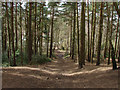
Frimley Fuel Allotments
A large area of wooded heath north of the Blackdown military training area characterised by these steep ridges (they look much steeper from the bottom)
Image: © Alan Hunt
Taken: 14 Apr 2013
0.18 miles
4
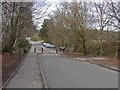
Alphington Avenue
The barrier across the end of Alphington Avenue. Beyond the road is called Tomlinscote Way. The sports field for Tomlinscote College are on the right.
Image: © Alan Hunt
Taken: 14 Apr 2013
0.18 miles
5
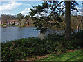
Tomlin's Pond
Tomlin's Pond from Croft Way. This pond is managed by the local council as a recreation area.
Image: © Alan Hunt
Taken: 16 Apr 2013
0.18 miles
6
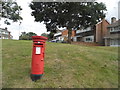
Grass bank and letterbox on Alphington Avenue
Image: © David Howard
Taken: 27 Jul 2015
0.19 miles
7
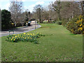
Tomlin's Avenue
The green running along Tomlin's Avenue with Tomlin's Pond on the right.
Image: © Alan Hunt
Taken: 16 Apr 2013
0.20 miles
8
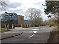
Tomlinscote Way
The entrance to Tomlinscote College on Tomlinscote Way
Image: © Alan Hunt
Taken: 14 Apr 2013
0.20 miles
9
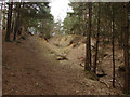
Frimley Fuel Allotments
An erosion gully on the scarp of a steep ridge. There is little vegetation in these pine woods to prevent erosion of this type.
Image: © Alan Hunt
Taken: 14 Apr 2013
0.21 miles