
IMAGES TAKEN NEAR TO
Ansell Road, CAMBERLEY, GU16 8DH
Introduction
This page details the photographs taken nearby to Ansell Road, GU16 8DH by members of the Geograph project.
The Geograph project started in 2005 with the aim of publishing, organising and preserving representative images for every square kilometre of Great Britain, Ireland and the Isle of Man.

There are currently over 7.5m images from over14,400 individuals and you can help contribute to the project by visiting https://www.geograph.org.uk
Image Map
Images are licensed for reuse under creativecommons.org/licenses/by-sa/2.0
Notes
- Clicking on the map will re-center to the selected point.
- The higher the marker number, the further away the image location is from the centre of the postcode.
Image Listing (31 Images Found)
Images are licensed for reuse under creativecommons.org/licenses/by-sa/2.0
Image
Details
Distance
1
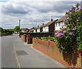
Top of Ansell Road, Frimley
Ansell Road is a mature residential area to the east of Frimley town centre, with houses built over fifty years ago. Towards the bottom of the road there is a convenience store and a pet shop. This photograph is taken from the highest point on Ansell Road; beyond here the road bends to the north and becomes Bret Harte Road, which goes steeply downhill.
Image: © Euchiasmus
Taken: 15 May 2014
0.01 miles
2
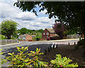
Bret Harte Road, Frimley
Bret Harte Road is named after Francis Bret Harte (1836–1902), the American author and poet, who died in Camberley and is buried in Frimley churchyard. This photograph shows the junction between Bret Harte Road, which goes down the hill to the left, and Middlemoor Road which leads off to the right.
Image: © Euchiasmus
Taken: 15 May 2014
0.06 miles
3
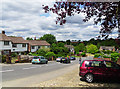
Bret Harte Road, Frimley
Bret Harte Road is named after Francis Bret Harte (1836–1902), the American author and poet, who died in Camberley and is buried a short distance from here in Frimley churchyard.
Stonehouse Rise can be seen leading off to the left just beyond the dark blue parked car.
The red building in the far distance is the Head Office of Siemens Power Generation UK.
Image: © Euchiasmus
Taken: 15 May 2014
0.06 miles
4
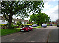
Purley Way, Frimley
Purley Way is a quiet residential road east of Frimley, running parallel to Ansell Road. The semi-detached houses are set back from the road, and wide grass verges and mature trees enhance the area.
Image: © Euchiasmus
Taken: 16 May 2014
0.08 miles
5
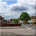
Junction of Ansell Road and Barnes Road, Frimley
Quiet roads in this residential area in the suburbs of Frimley.
Image: © Euchiasmus
Taken: 15 May 2014
0.09 miles
7
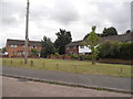
Green on Barnes Road
Compare with this larger version in Edgware, the houses and road design appear to come from the same plans.
http://www.geograph.org.uk/photo/4538706
Image: © David Howard
Taken: 27 Jul 2015
0.10 miles
8
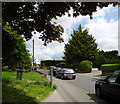
Ansell Road, Frimley
Ansell Road is a residential road leading east from the B3411 (Frimley Green Road). A little further up the road there is a convenience store and a pet shop.
Image: © Euchiasmus
Taken: 15 May 2014
0.15 miles
9
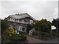
Chalet style house on Alphington Avenue, Frimley
Image: © David Howard
Taken: 27 Jul 2015
0.16 miles
10
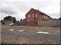
Barnes Road at the junction of Middlemoor Road
Image: © David Howard
Taken: 27 Jul 2015
0.16 miles