IMAGES TAKEN NEAR TO
Barnes Road, CAMBERLEY, GU16 8BY
Introduction
This page details the photographs taken nearby to Barnes Road, GU16 8BY by members of the Geograph project.
The Geograph project started in 2005 with the aim of publishing, organising and preserving representative images for every square kilometre of Great Britain, Ireland and the Isle of Man.

There are currently over 7.5m images from over14,400 individuals and you can help contribute to the project by visiting https://www.geograph.org.uk
Image Map (Loading...)


Getting Data...Please wait
Leaflet Map data © OpenStreetMap
Images are licensed for reuse under creativecommons.org/licenses/by-sa/2.0
Notes
- Clicking on the map will re-center to the selected point.
- The higher the marker number, the further away the image location is from the centre of the postcode.
Image Listing (23 Images Found)
Images are licensed for reuse under creativecommons.org/licenses/by-sa/2.0
Image
Details
Distance
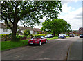
1
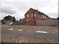
Barnes Road at the junction of Middlemoor Road
Image: © David Howard
Taken: 27 Jul 2015
0.03 miles
2
Barnes Road at the junction of Middlemoor Road
Image: © David Howard
Taken: 27 Jul 2015
0.04 miles
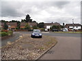
3
Green on Barnes Road
Compare with this larger version in Edgware, the houses and road design appear to come from the same plans.
http://www.geograph.org.uk/photo/4538706
Image: © David Howard
Taken: 27 Jul 2015
0.04 miles
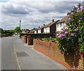
5
Purley Way, Frimley
Purley Way is a quiet residential road east of Frimley, running parallel to Ansell Road. The semi-detached houses are set back from the road, and wide grass verges and mature trees enhance the area.
Image: © Euchiasmus
Taken: 16 May 2014
0.08 miles

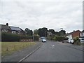
7
Top of Ansell Road, Frimley
Ansell Road is a mature residential area to the east of Frimley town centre, with houses built over fifty years ago. Towards the bottom of the road there is a convenience store and a pet shop. This photograph is taken from the highest point on Ansell Road; beyond here the road bends to the north and becomes Bret Harte Road, which goes steeply downhill.
Image: © Euchiasmus
Taken: 15 May 2014
0.13 miles
8
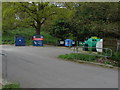
Recycling centre, Balmoral Drive
The recycling centre next to the carpark of the community centre on Balmoral Drive
Image: © Alan Hunt
Taken: 17 Apr 2011
0.13 miles
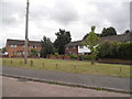
9
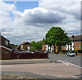
Junction of Ansell Road and Barnes Road, Frimley
Quiet roads in this residential area in the suburbs of Frimley.
Image: © Euchiasmus
Taken: 15 May 2014
0.14 miles
10
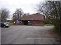
Community Centre Near Frimley
This centre has a nice hall and a reasonable stage.
Image: © Graham Clutton
Taken: 5 Jan 2006
0.15 miles