
IMAGES TAKEN NEAR TO
Bellew Road, CAMBERLEY, GU16 6QN
Introduction
This page details the photographs taken nearby to Bellew Road, GU16 6QN by members of the Geograph project.
The Geograph project started in 2005 with the aim of publishing, organising and preserving representative images for every square kilometre of Great Britain, Ireland and the Isle of Man.

There are currently over 7.5m images from over14,400 individuals and you can help contribute to the project by visiting https://www.geograph.org.uk
Image Map
Images are licensed for reuse under creativecommons.org/licenses/by-sa/2.0
Notes
- Clicking on the map will re-center to the selected point.
- The higher the marker number, the further away the image location is from the centre of the postcode.
Image Listing (21 Images Found)
Images are licensed for reuse under creativecommons.org/licenses/by-sa/2.0
Image
Details
Distance
2
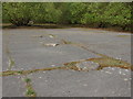
Blackdown Hill training area
A line of concrete bases in a large area of hardstanding that must have been workshops or garages in the past.
Image: © Alan Hunt
Taken: 17 Apr 2011
0.10 miles
3
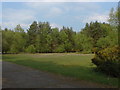
Blackdown training area
One of the many open areas in the Blackdown military training area.
Image: © Alan Hunt
Taken: 17 Apr 2011
0.12 miles
4
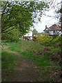
Blackdown Hill training area
The footpath that runs parallel with Blackdown Road, with the houses on Blackdown Road in the background.
Image: © Alan Hunt
Taken: 17 Apr 2011
0.15 miles
7
Ministry of Defence land off Blackdown Road
Image: © David Howard
Taken: 11 Jan 2012
0.19 miles
8
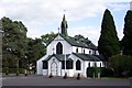
The Garrison church of St Barbara at Deepcut
Unusually constructed of corrugated iron (then considered an advanced building material), the Garrison Church in Deepcut was built in 1901 to serve units then stationed in the immediate area. It was officially dedicated on 29 September 1901 as St Michael and All Angels Garrison Church. In 1905 an adjoining acre of land was acquired from the Crown as a burial ground. Electricity was installed in 1911 and the stained glass east windows in 1922. The church was renamed in 1967. A brass plate and a window commemorate the formation of The Royal Logistic Corps, whose Book of Remembrance has been placed in the Church. The Corps Book of Remembrance is kept in St Barbara’s Church and contains the names of all those who have died whilst serving in the RLC, whether on duty or off duty.
Image: © Ron Strutt
Taken: 29 Sep 2005
0.21 miles
9
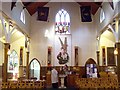
St Barbara's Church
The West wall of St Barbara's church showing the plaster relief of St Michael and the Dragon. The original name of the church was 'St Michael & All Angels' . St Barbara was adopted as the Patron Saint of the Royal Army Ordnance Corps in 1922, and the church was rededicated to St Barbara on 1st October 1967. For another view of the interior refer to picture Image
Image: © Len Williams
Taken: 22 Jan 2012
0.22 miles
10
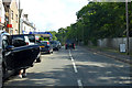
B3015 Deepcut Bridge Road
Passing north through Deepcut.
Image: © Robin Webster
Taken: 9 Jun 2019
0.22 miles