IMAGES TAKEN NEAR TO
Brunswick Road, GU16 6FF
Introduction
This page details the photographs taken nearby to Brunswick Road, GU16 6FF by members of the Geograph project.
The Geograph project started in 2005 with the aim of publishing, organising and preserving representative images for every square kilometre of Great Britain, Ireland and the Isle of Man.

There are currently over 7.5m images from over14,400 individuals and you can help contribute to the project by visiting https://www.geograph.org.uk
Image Map
Images are licensed for reuse under creativecommons.org/licenses/by-sa/2.0
Notes
- Clicking on the map will re-center to the selected point.
- The higher the marker number, the further away the image location is from the centre of the postcode.
Image Listing (38 Images Found)
Images are licensed for reuse under creativecommons.org/licenses/by-sa/2.0
Image
Details
Distance
1
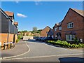
Navigating northwards up the Basher (23)
Looking from Thornycroft Avenue into Huntspill Drive
Image: © Basher Eyre
Taken: 6 Jun 2023
0.10 miles
2
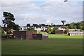
Deepcut Army Camp
Deepcut Camp is the headquarters of the Royal Logistic Corps, which was formed in 1993 from the Royal Corps of Transport, the Royal Army Ordnance Corps, the Royal Pioneer Corps, the Army Catering Corps and the Postal and Courier Section of The Royal Engineers. The Corps provides the rest of the British Army with essential support, including vehicles, spares, equipment, weapons, ammunition, fuel, food and water.
Image: © Ron Strutt
Taken: 29 Sep 2005
0.12 miles
3

Bourne Grove, Deepcut
Some of the new houses built on land previously occupied by the military.
Image: © Des Blenkinsopp
Taken: 1 Apr 2025
0.13 miles
4

Path beside the New Houses
A lot of new housing is being built on former military land on the north side of the Basingstoke Canal.
This path is along the present eastern side of the development.
Image: © Des Blenkinsopp
Taken: 1 Apr 2025
0.14 miles
6
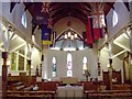
St Barbara's Church
The altar and stained glass windows at the East end of St Barbara's. The windows celebrate St George, Christ in Glory and St Patrick. Originally the windows were in the Portobello Barracks Chapel, Dublin, but were re-sited in October 1922. For a view of the West wall refer to picture Image
Image: © Len Williams
Taken: 22 Jan 2012
0.16 miles
8
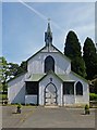
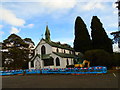
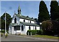
Tin tabernacle, Deepcut
The corrugated iron garrison church of St Barbara, Deepcut was erected in 1901. It is Grade II listed, described at this http://list.historicengland.org.uk/resultsingle.aspx?uid=1180168. For an earlier example of a 'tin tabernacle' see Image
Image: © Jim Osley
Taken: 18 Jun 2015
0.16 miles
9
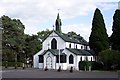
The Garrison church of St Barbara at Deepcut
Unusually constructed of corrugated iron (then considered an advanced building material), the Garrison Church in Deepcut was built in 1901 to serve units then stationed in the immediate area. It was officially dedicated on 29 September 1901 as St Michael and All Angels Garrison Church. In 1905 an adjoining acre of land was acquired from the Crown as a burial ground. Electricity was installed in 1911 and the stained glass east windows in 1922. The church was renamed in 1967. A brass plate and a window commemorate the formation of The Royal Logistic Corps, whose Book of Remembrance has been placed in the Church. The Corps Book of Remembrance is kept in St Barbara’s Church and contains the names of all those who have died whilst serving in the RLC, whether on duty or off duty.
Image: © Ron Strutt
Taken: 29 Sep 2005
0.16 miles