IMAGES TAKEN NEAR TO
Kings Ride, CAMBERLEY, GU15 4LZ
Introduction
This page details the photographs taken nearby to Kings Ride, GU15 4LZ by members of the Geograph project.
The Geograph project started in 2005 with the aim of publishing, organising and preserving representative images for every square kilometre of Great Britain, Ireland and the Isle of Man.

There are currently over 7.5m images from over14,400 individuals and you can help contribute to the project by visiting https://www.geograph.org.uk
Image Map
Images are licensed for reuse under creativecommons.org/licenses/by-sa/2.0
Notes
- Clicking on the map will re-center to the selected point.
- The higher the marker number, the further away the image location is from the centre of the postcode.
Image Listing (25 Images Found)
Images are licensed for reuse under creativecommons.org/licenses/by-sa/2.0
Image
Details
Distance
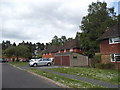
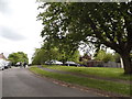
1
Paddock, King's Ride
A small paddock that has been in use here for many years.
Image: © don cload
Taken: 6 Apr 2009
0.05 miles
2
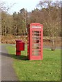
Kings Ride, Camberley
The phone and post box at the junction of Matthews Road with King's Ride. These old red phone boxes are falling into disuse with the advent of mobile phones.
Image: © Alan Hunt
Taken: 18 Feb 2013
0.07 miles
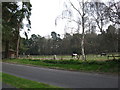
3
Matthews Road
Matthews Road looking towards the junction with King's Ride.
Image: © Alan Hunt
Taken: 18 Feb 2013
0.08 miles
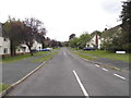
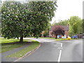
5
Matthews Road at the junction of Kings Ride
Image: © David Howard
Taken: 17 May 2015
0.09 miles
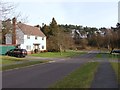
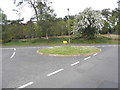
8
Roundabout on Matthews Road, Camberley
Image: © David Howard
Taken: 17 May 2015
0.11 miles
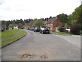
9
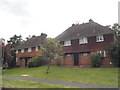
Houses on Queen Elizabeth Road, Camberley
Image: © David Howard
Taken: 17 May 2015
0.11 miles